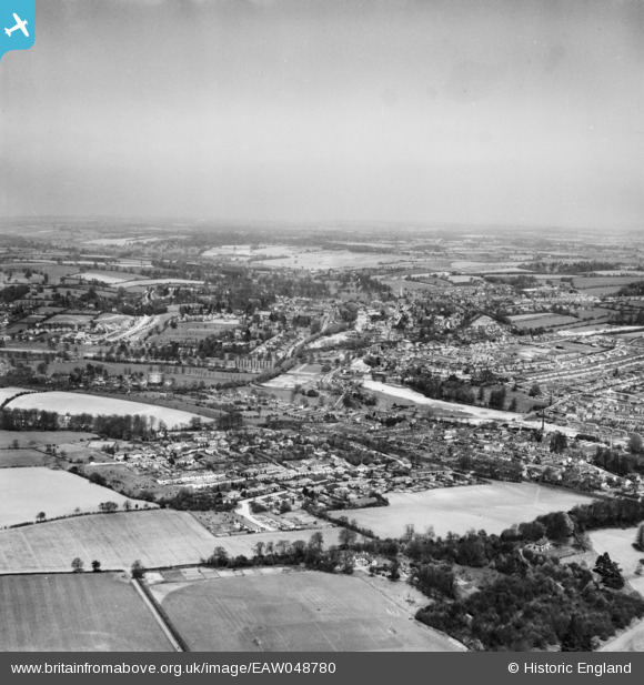
EAW048780 ENGLAND (1953). The town, Hemel Hempstead, from the south, 1953
© Copyright OpenStreetMap contributors and licensed by the OpenStreetMap Foundation. 2025. Cartography is licensed as CC BY-SA.
Nearby Images (3)
EAW048780

EAW048779

EPW016001

Details
| Title | [EAW048780] The town, Hemel Hempstead, from the south, 1953 |
| Reference | EAW048780 |
| Date | 22-April-1953 |
| Link | |
| Place name | HEMEL HEMPSTEAD |
| Parish | |
| District | |
| Country | ENGLAND |
| Easting / Northing | 505570, 205131 |
| Longitude / Latitude | -0.47105099863957, 51.734478767595 |
| National Grid Reference | TL056051 |
Pins
 Baz 1969 |
Friday 27th of November 2020 06:20:02 PM | |
Baz 1969 |
Friday 27th of November 2020 07:44:56 AM | |
Baz 1969 |
Friday 27th of November 2020 07:44:00 AM | |
H.E. |
Tuesday 27th of February 2018 04:09:29 PM | |
H.E. |
Tuesday 27th of February 2018 04:08:06 PM | |
H.E. |
Tuesday 27th of February 2018 04:06:46 PM | |
H.E. |
Tuesday 27th of February 2018 04:00:43 PM | |
H.E. |
Tuesday 27th of February 2018 03:59:35 PM | |
H.E. |
Tuesday 27th of February 2018 03:56:42 PM | |
H.E. |
Tuesday 27th of February 2018 03:55:43 PM | |
H.E. |
Tuesday 27th of February 2018 03:53:10 PM | |
H.E. |
Wednesday 14th of January 2015 06:18:25 PM |