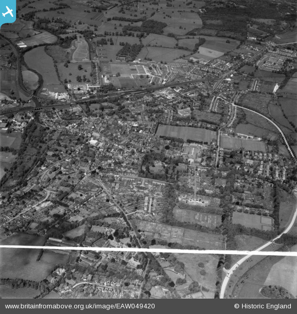
EAW049420 ENGLAND (1953). The town, Leatherhead, 1953. This image was marked by Aerofilms Ltd for photo editing.
© Copyright OpenStreetMap contributors and licensed by the OpenStreetMap Foundation. 2025. Cartography is licensed as CC BY-SA.
Nearby Images (11)
Details
| Title | [EAW049420] The town, Leatherhead, 1953. This image was marked by Aerofilms Ltd for photo editing. |
| Reference | EAW049420 |
| Date | 19-May-1953 |
| Link | |
| Place name | LEATHERHEAD |
| Parish | |
| District | |
| Country | ENGLAND |
| Easting / Northing | 516813, 156567 |
| Longitude / Latitude | -0.32439091836224, 51.295725790796 |
| National Grid Reference | TQ168566 |
Pins
 OldAdam |
Saturday 2nd of September 2023 06:35:15 PM | |
 OldAdam |
Saturday 2nd of September 2023 06:34:19 PM | |
 OldAdam |
Saturday 2nd of September 2023 06:30:24 PM | |
 David960 |
Tuesday 10th of February 2015 07:46:01 PM | |
 JP |
Thursday 31st of July 2014 05:20:58 PM | |
 JP |
Thursday 31st of July 2014 05:15:23 PM | |
 JP |
Thursday 31st of July 2014 05:12:52 PM | |
 JP |
Thursday 31st of July 2014 05:12:13 PM |


![[EAW049420] The town, Leatherhead, 1953. This image was marked by Aerofilms Ltd for photo editing.](http://britainfromabove.org.uk/sites/all/libraries/aerofilms-images/public/100x100/EAW/049/EAW049420.jpg)
![[EPW025244] St John's School, Leatherhead, 1928](http://britainfromabove.org.uk/sites/all/libraries/aerofilms-images/public/100x100/EPW/025/EPW025244.jpg)
![[EPW006236] St John's School, Leatherhead, 1921](http://britainfromabove.org.uk/sites/all/libraries/aerofilms-images/public/100x100/EPW/006/EPW006236.jpg)
![[EPW006235] St John's School, Leatherhead, 1921](http://britainfromabove.org.uk/sites/all/libraries/aerofilms-images/public/100x100/EPW/006/EPW006235.jpg)
![[EPW032796] St John's Foundation School, Leatherhead, 1930](http://britainfromabove.org.uk/sites/all/libraries/aerofilms-images/public/100x100/EPW/032/EPW032796.jpg)
![[EPW025245] St John's School, Leatherhead, 1928](http://britainfromabove.org.uk/sites/all/libraries/aerofilms-images/public/100x100/EPW/025/EPW025245.jpg)
![[EPW032798] The High Street, Leatherhead, 1930](http://britainfromabove.org.uk/sites/all/libraries/aerofilms-images/public/100x100/EPW/032/EPW032798.jpg)
![[EPW025242] The town and surrounding countryside, Leatherhead, from the east, 1928](http://britainfromabove.org.uk/sites/all/libraries/aerofilms-images/public/100x100/EPW/025/EPW025242.jpg)
![[EAW049421] The town, Leatherhead, 1953](http://britainfromabove.org.uk/sites/all/libraries/aerofilms-images/public/100x100/EAW/049/EAW049421.jpg)
![[EAW049419] The town, Leatherhead, 1953](http://britainfromabove.org.uk/sites/all/libraries/aerofilms-images/public/100x100/EAW/049/EAW049419.jpg)
![[EPW006233] General view of St Mary and St Nicholas's Church and Church Street, Leatherhead, 1921](http://britainfromabove.org.uk/sites/all/libraries/aerofilms-images/public/100x100/EPW/006/EPW006233.jpg)