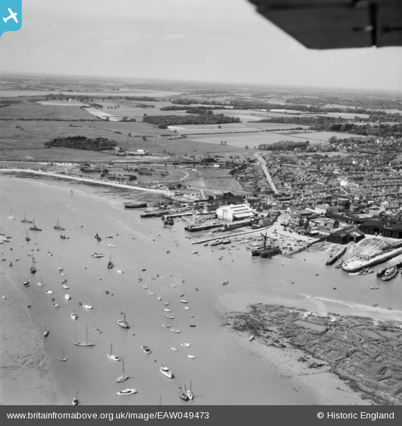
EAW049473 ENGLAND (1953). Brightlingsea Creek, the waterfront and town, Brightlingsea, from the south-east, 1953
© Copyright OpenStreetMap contributors and licensed by the OpenStreetMap Foundation. 2024. Cartography is licensed as CC BY-SA.
Nearby Images (8)
Details
| Title | [EAW049473] Brightlingsea Creek, the waterfront and town, Brightlingsea, from the south-east, 1953 |
| Reference | EAW049473 |
| Date | 19-May-1953 |
| Link | |
| Place name | BRIGHTLINGSEA |
| Parish | BRIGHTLINGSEA |
| District | |
| Country | ENGLAND |
| Easting / Northing | 608627, 215987 |
| Longitude / Latitude | 1.0263341684336, 51.803090145602 |
| National Grid Reference | TM086160 |
Pins
 Sparky |
Thursday 26th of October 2017 08:13:10 PM | |
 john |
Saturday 4th of April 2015 02:52:04 AM | |
 john |
Saturday 4th of April 2015 02:51:28 AM | |
 john |
Saturday 4th of April 2015 02:49:59 AM | |
 john |
Saturday 4th of April 2015 02:49:31 AM | |
 MB |
Monday 9th of June 2014 10:21:48 AM | |
 MB |
Monday 9th of June 2014 10:21:09 AM | |
 MB |
Monday 9th of June 2014 10:19:42 AM | |
 MB |
Monday 9th of June 2014 10:18:52 AM |


![[EAW049473] Brightlingsea Creek, the waterfront and town, Brightlingsea, from the south-east, 1953](http://britainfromabove.org.uk/sites/all/libraries/aerofilms-images/public/100x100/EAW/049/EAW049473.jpg)
![[EPW041411] The town, Brightlingsea, from the south-east, 1933](http://britainfromabove.org.uk/sites/all/libraries/aerofilms-images/public/100x100/EPW/041/EPW041411.jpg)
![[EAW049472] The waterfront and town, Brightlingsea, from the south, 1953](http://britainfromabove.org.uk/sites/all/libraries/aerofilms-images/public/100x100/EAW/049/EAW049472.jpg)
![[EAW024663] Brightlingsea Creek, the waterfront and town, Brightlingsea, from the south-east, 1949](http://britainfromabove.org.uk/sites/all/libraries/aerofilms-images/public/100x100/EAW/024/EAW024663.jpg)
![[EAW024664] Brightlingsea Creek, the waterfront and town, Brightlingsea, from the south-east, 1949](http://britainfromabove.org.uk/sites/all/libraries/aerofilms-images/public/100x100/EAW/024/EAW024664.jpg)
![[EPW014282] The wharf and the town, Brightlingsea, 1925. This image has been produced from a print.](http://britainfromabove.org.uk/sites/all/libraries/aerofilms-images/public/100x100/EPW/014/EPW014282.jpg)
![[EPW014285] Waterside and environs, Brightlingsea, 1925. This image has been produced from a copy-negative.](http://britainfromabove.org.uk/sites/all/libraries/aerofilms-images/public/100x100/EPW/014/EPW014285.jpg)
![[EAW049471] The waterfront and town, Brightlingsea, from the west, 1953](http://britainfromabove.org.uk/sites/all/libraries/aerofilms-images/public/100x100/EAW/049/EAW049471.jpg)