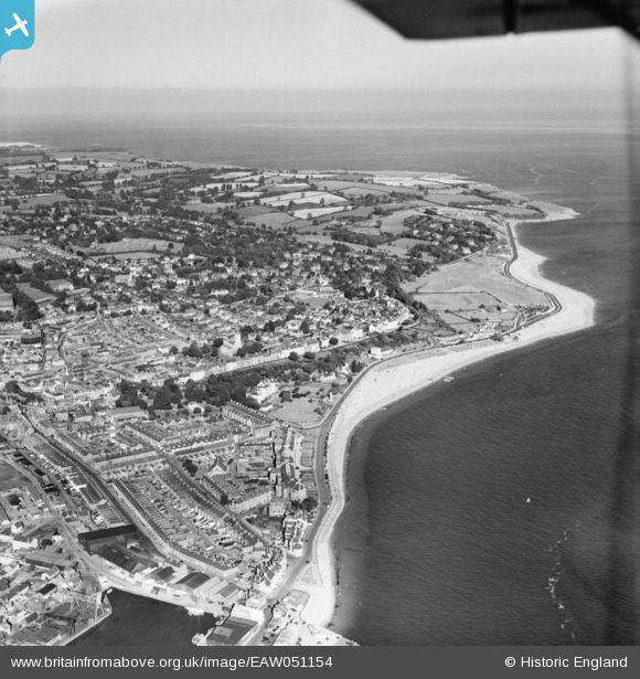
EAW051154 ENGLAND (1953). The town and the surrounding coastline, Exmouth, from the west, 1953
© Copyright OpenStreetMap contributors and licensed by the OpenStreetMap Foundation. 2025. Cartography is licensed as CC BY-SA.
Nearby Images (7)
Details
| Title | [EAW051154] The town and the surrounding coastline, Exmouth, from the west, 1953 |
| Reference | EAW051154 |
| Date | 10-August-1953 |
| Link | |
| Place name | EXMOUTH |
| Parish | EXMOUTH |
| District | |
| Country | ENGLAND |
| Easting / Northing | 299737, 80584 |
| Longitude / Latitude | -3.4173572153299, 50.615752819354 |
| National Grid Reference | SX997806 |
Pins
Be the first to add a comment to this image!


![[EAW051154] The town and the surrounding coastline, Exmouth, from the west, 1953](http://britainfromabove.org.uk/sites/all/libraries/aerofilms-images/public/100x100/EAW/051/EAW051154.jpg)
![[EPW023667] The Esplanade, Exmouth, from the west, 1928.](http://britainfromabove.org.uk/sites/all/libraries/aerofilms-images/public/100x100/EPW/023/EPW023667.jpg)
![[EAW031935] The Point and the River Exe, Exmouth, from the south-east, 1950](http://britainfromabove.org.uk/sites/all/libraries/aerofilms-images/public/100x100/EAW/031/EAW031935.jpg)
![[EAW015002] The town, Exmouth, from the south-west, 1948. This image has been produced from a print.](http://britainfromabove.org.uk/sites/all/libraries/aerofilms-images/public/100x100/EAW/015/EAW015002.jpg)
![[EPW023678] The Jubilee Clock on the Esplanade, Exmouth, 1928](http://britainfromabove.org.uk/sites/all/libraries/aerofilms-images/public/100x100/EPW/023/EPW023678.jpg)
![[EPW039693] The docks and environs, Exmouth, 1932](http://britainfromabove.org.uk/sites/all/libraries/aerofilms-images/public/100x100/EPW/039/EPW039693.jpg)
![[EAW051153] Exmouth Dock, The Point and environs, Exmouth, 1953](http://britainfromabove.org.uk/sites/all/libraries/aerofilms-images/public/100x100/EAW/051/EAW051153.jpg)