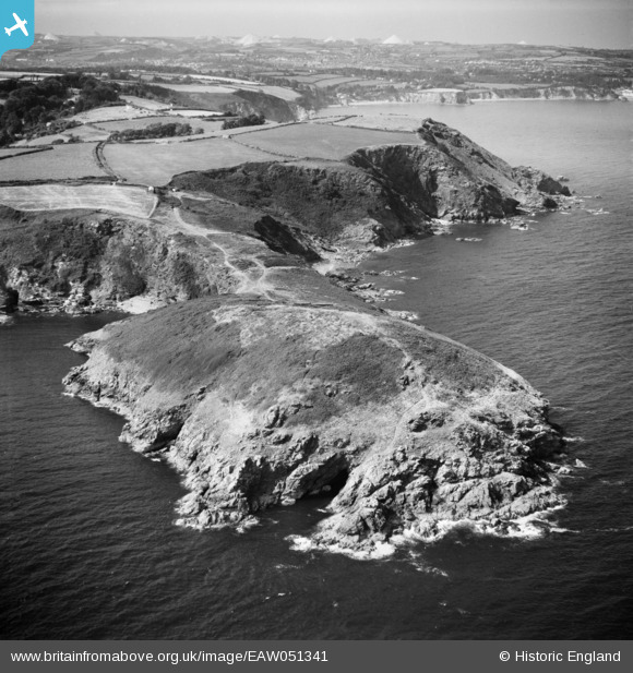
EAW051341 ENGLAND (1953). Black Head, The Bite and the surrounding area, Hallane, from the south-east, 1953
© Copyright OpenStreetMap contributors and licensed by the OpenStreetMap Foundation. 2025. Cartography is licensed as CC BY-SA.
Details
| Title | [EAW051341] Black Head, The Bite and the surrounding area, Hallane, from the south-east, 1953 |
| Reference | EAW051341 |
| Date | 11-August-1953 |
| Link | |
| Place name | HALLANE |
| Parish | ST. AUSTELL BAY |
| District | |
| Country | ENGLAND |
| Easting / Northing | 203983, 47888 |
| Longitude / Latitude | -4.7525950767492, 50.297709344242 |
| National Grid Reference | SX040479 |
Pins
 CornwallPhil |
Thursday 27th of November 2014 10:04:45 PM | |
 CornwallPhil |
Thursday 27th of November 2014 10:03:28 PM | |
 CornwallPhil |
Thursday 27th of November 2014 10:02:40 PM | |
 CornwallPhil |
Thursday 27th of November 2014 10:01:54 PM | |
 CornwallPhil |
Thursday 27th of November 2014 10:01:10 PM | |
 CornwallPhil |
Thursday 27th of November 2014 10:00:38 PM |
User Comment Contributions
 CornwallPhil |
Thursday 27th of November 2014 10:06:44 PM |


![[EAW051341] Black Head, The Bite and the surrounding area, Hallane, from the south-east, 1953](http://britainfromabove.org.uk/sites/all/libraries/aerofilms-images/public/100x100/EAW/051/EAW051341.jpg)
![[EAW051340] Black Head, Drennick and the surrounding area, Hallane, from the east, 1953](http://britainfromabove.org.uk/sites/all/libraries/aerofilms-images/public/100x100/EAW/051/EAW051340.jpg)
![[EAW004893] Drennick, Black Head, 1947](http://britainfromabove.org.uk/sites/all/libraries/aerofilms-images/public/100x100/EAW/004/EAW004893.jpg)
