
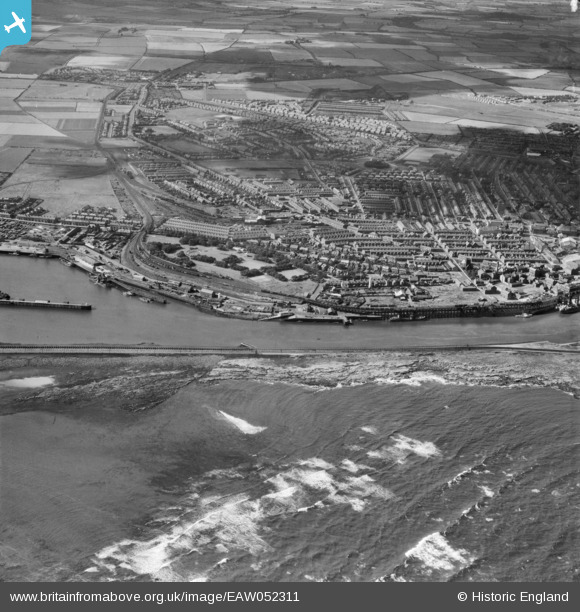
EAW052311 ENGLAND (1953). Ridley Park and environs, Blyth, 1953
© Copyright OpenStreetMap contributors and licensed by the OpenStreetMap Foundation. 2025. Cartography is licensed as CC BY-SA.
Nearby Images (5)
EAW052311

EPW048820

EPW048828

EPW048825

EPW048839

Details
| Title | [EAW052311] Ridley Park and environs, Blyth, 1953 |
| Reference | EAW052311 |
| Date | 10-September-1953 |
| Link | |
| Place name | BLYTH |
| Parish | BLYTH |
| District | |
| Country | ENGLAND |
| Easting / Northing | 432069, 581229 |
| Longitude / Latitude | -1.4970681197622, 55.124345133532 |
| National Grid Reference | NZ321812 |
