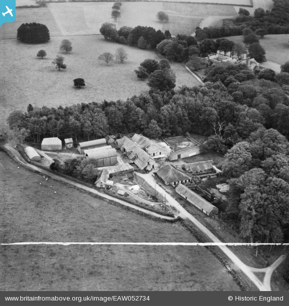
EAW052734 ENGLAND (1953) [Unlocated]. UNLOCATED. This image was marked by Aerofilms Ltd for photo editing.
© Copyright OpenStreetMap contributors and licensed by the OpenStreetMap Foundation. 2025. Cartography is licensed as CC BY-SA.
Nearby Images (48)
Details
| Title | [EAW052734] UNLOCATED. This image was marked by Aerofilms Ltd for photo editing. |
| Reference | EAW052734 |
| Date | October-1953 |
| Link | |
| Place name | |
| Parish | |
| District | |
| Country | ENGLAND |
| Easting / Northing | 0, 0 |
| Longitude / Latitude | -7.556448482059, 49.766185796754 |
| National Grid Reference | SV000000 |
Pins
 ewnmcg |
Monday 3rd of November 2014 10:23:30 PM |
User Comment Contributions
Ffynone Pembrokeshire |
 James Chandler |
Saturday 23rd of July 2016 02:39:47 PM |
EAW052727 EAW052728 EAW052729 EAW052730 EAW052731 EAW052732 EAW052733 EAW052734 EAW052735 EAW052736 were all taken in October 1953 and cover the same area. |
 Class31 |
Wednesday 5th of November 2014 02:41:18 PM |


![[EPW000143] UNLOCATED](http://britainfromabove.org.uk/sites/all/libraries/aerofilms-images/public/100x100/EPW/000/EPW000143.jpg)
![[EPW000667] Vessel at Sea](http://britainfromabove.org.uk/sites/all/libraries/aerofilms-images/public/100x100/EPW/000/EPW000667.jpg)
![[EPW005260] UNLOCATED](http://britainfromabove.org.uk/sites/all/libraries/aerofilms-images/public/100x100/EPW/005/EPW005260.jpg)
![[EPW006389] The R33 airship in flight over the Epsom Downs (unlocated), 1921](http://britainfromabove.org.uk/sites/all/libraries/aerofilms-images/public/100x100/EPW/006/EPW006389.jpg)
![[EPW007181] UNLOCATED](http://britainfromabove.org.uk/sites/all/libraries/aerofilms-images/public/100x100/EPW/007/EPW007181.jpg)
![[EPW015853] Cloudscape, 1926](http://britainfromabove.org.uk/sites/all/libraries/aerofilms-images/public/100x100/EPW/015/EPW015853.jpg)
![[EPW015854] Cloudscape, 1926](http://britainfromabove.org.uk/sites/all/libraries/aerofilms-images/public/100x100/EPW/015/EPW015854.jpg)
![[EPW015855] Cloudscape, 1926](http://britainfromabove.org.uk/sites/all/libraries/aerofilms-images/public/100x100/EPW/015/EPW015855.jpg)
![[EPW016012] UNLOCATED](http://britainfromabove.org.uk/sites/all/libraries/aerofilms-images/public/100x100/EPW/016/EPW016012.jpg)
![[EPW016510] Cloudscape, 1926](http://britainfromabove.org.uk/sites/all/libraries/aerofilms-images/public/100x100/EPW/016/EPW016510.jpg)
![[EPW016641] EPW016641](http://britainfromabove.org.uk/sites/all/libraries/aerofilms-images/public/100x100/EPW/016/EPW016641.jpg)
![[EPW017028] Cloudscape, 1926](http://britainfromabove.org.uk/sites/all/libraries/aerofilms-images/public/100x100/EPW/017/EPW017028.jpg)
![[EPW017029] Cloudscape, 1926](http://britainfromabove.org.uk/sites/all/libraries/aerofilms-images/public/100x100/EPW/017/EPW017029.jpg)
![[EPW017136] A vessel at sea off Beachy Head, from the east, 1926](http://britainfromabove.org.uk/sites/all/libraries/aerofilms-images/public/100x100/EPW/017/EPW017136.jpg)
![[SAW003585] Skiddaw, Lake District. Oblique aerial photograph.](http://britainfromabove.org.uk/sites/all/libraries/aerofilms-images/public/100x100/SAW/003/SAW003585.jpg)
![[SAW003586] Unlocated mountains, possibly near Ben Nevis. An oblique aerial photograph.](http://britainfromabove.org.uk/sites/all/libraries/aerofilms-images/public/100x100/SAW/003/SAW003586.jpg)
![[SAW009337] Wigtown Bay, general view, showing Ringdoo Point. An oblique aerial photograph taken facing west.](http://britainfromabove.org.uk/sites/all/libraries/aerofilms-images/public/100x100/SAW/009/SAW009337.jpg)
![[SAW009800] Clouds. An oblique aerial photograph.](http://britainfromabove.org.uk/sites/all/libraries/aerofilms-images/public/100x100/SAW/009/SAW009800.jpg)
![[SAW009801] Clouds. An oblique aerial photograph.](http://britainfromabove.org.uk/sites/all/libraries/aerofilms-images/public/100x100/SAW/009/SAW009801.jpg)
![[SAW009802] Unlocated, Scotland, 1947. An oblique Aerial photograph.](http://britainfromabove.org.uk/sites/all/libraries/aerofilms-images/public/100x100/SAW/009/SAW009802.jpg)
![[SAW010734] Clouds. An oblique aerial photograph.](http://britainfromabove.org.uk/sites/all/libraries/aerofilms-images/public/100x100/SAW/010/SAW010734.jpg)
![[SAW014737] Dalliefour Wood and River Dee, Balmoral Estate. An oblique aerial photograph taken facing east.](http://britainfromabove.org.uk/sites/all/libraries/aerofilms-images/public/100x100/SAW/014/SAW014737.jpg)
![[SAW017926] Unlocated image of haymaking, Dunbartonshire. An oblique aerial photograph.](http://britainfromabove.org.uk/sites/all/libraries/aerofilms-images/public/100x100/SAW/017/SAW017926.jpg)
![[SAW017927] Loch Ard Forest, general view showing Beinn Bhreac, Loch Ard and Ben Venue. An oblique aerial photograph taken facing north-east. This image has been produced from a damaged negative.](http://britainfromabove.org.uk/sites/all/libraries/aerofilms-images/public/100x100/SAW/017/SAW017927.jpg)
![[SAW032504] Unlocated country house, possibly near Ardanaiseig. Oblique aerial photograph. This image has been produced from a crop marked negative.](http://britainfromabove.org.uk/sites/all/libraries/aerofilms-images/public/100x100/SAW/032/SAW032504.jpg)
![[SPW020275] Scottish Dyes Ltd. Works, Grangemouth. An oblique aerial photograph taken facing north-west.](http://britainfromabove.org.uk/sites/all/libraries/aerofilms-images/public/100x100/SPW/020/SPW020275.jpg)
![[SPW020280] Birds flying low between Grangemouth and Culross, Firth of Forth. An oblique aerial photograph.](http://britainfromabove.org.uk/sites/all/libraries/aerofilms-images/public/100x100/SPW/020/SPW020280.jpg)
![[SPW020281] Birds flying low between Grangemouth and Culross, Firth of Forth. An oblique aerial photograph.](http://britainfromabove.org.uk/sites/all/libraries/aerofilms-images/public/100x100/SPW/020/SPW020281.jpg)
![[SPW020284] Ochil Hills, general view, showing Carsebreck Loch and Lower and Upper Rhynd Reservoirs. An oblique aerial photograph taken facing north-west.](http://britainfromabove.org.uk/sites/all/libraries/aerofilms-images/public/100x100/SPW/020/SPW020284.jpg)
![[SPW020632] Unlocated moorland. An oblique aerial photograph.](http://britainfromabove.org.uk/sites/all/libraries/aerofilms-images/public/100x100/SPW/020/SPW020632.jpg)
![[SPW020633] Unlocated moorland. An oblique aerial photograph.](http://britainfromabove.org.uk/sites/all/libraries/aerofilms-images/public/100x100/SPW/020/SPW020633.jpg)
![[SPW027083] Unlocated hills in Peeblesshire. An oblique aerial photograph.](http://britainfromabove.org.uk/sites/all/libraries/aerofilms-images/public/100x100/SPW/027/SPW027083.jpg)
![[SPW049776] Queen Mary, Firth of Clyde. An oblique aerial photograph.](http://britainfromabove.org.uk/sites/all/libraries/aerofilms-images/public/100x100/SPW/049/SPW049776.jpg)
![[SPW049777] Queen Mary, Firth of Clyde. An oblique aerial photograph.](http://britainfromabove.org.uk/sites/all/libraries/aerofilms-images/public/100x100/SPW/049/SPW049777.jpg)
![[SPW049779] Queen Mary, Firth of Clyde. An oblique aerial photograph.](http://britainfromabove.org.uk/sites/all/libraries/aerofilms-images/public/100x100/SPW/049/SPW049779.jpg)
![[SPW049783] Queen Mary, Firth of Clyde. An oblique aerial photograph.](http://britainfromabove.org.uk/sites/all/libraries/aerofilms-images/public/100x100/SPW/049/SPW049783.jpg)
![[SPW049791] Queen Mary, River Clyde. An oblique aerial photograph.](http://britainfromabove.org.uk/sites/all/libraries/aerofilms-images/public/100x100/SPW/049/SPW049791.jpg)
![[SPW049798] Queen Mary, Firth of Clyde. An oblique aerial photograph.](http://britainfromabove.org.uk/sites/all/libraries/aerofilms-images/public/100x100/SPW/049/SPW049798.jpg)
![[SPW049801] Queen Mary, Firth of Clyde. An oblique aerial photograph.](http://britainfromabove.org.uk/sites/all/libraries/aerofilms-images/public/100x100/SPW/049/SPW049801.jpg)
![[SPW049827] Queen Mary, Firth of Clyde. Speed trials. An oblique aerial photograph. This image has been produced from a damaged negative.](http://britainfromabove.org.uk/sites/all/libraries/aerofilms-images/public/100x100/SPW/049/SPW049827.jpg)
![[SPW049828] Queen Mary, Firth of Clyde. Speed trials. An oblique aerial photograph. This image has been produced from a damaged negative.](http://britainfromabove.org.uk/sites/all/libraries/aerofilms-images/public/100x100/SPW/049/SPW049828.jpg)
![[SPW049831] Queen Mary, Firth of Clyde. Speed trials. An oblique aerial photograph. This image has been produced from a damaged negative.](http://britainfromabove.org.uk/sites/all/libraries/aerofilms-images/public/100x100/SPW/049/SPW049831.jpg)
![[SPW049832] Queen Mary, Firth of Clyde. Speed trials. An oblique aerial photograph.](http://britainfromabove.org.uk/sites/all/libraries/aerofilms-images/public/100x100/SPW/049/SPW049832.jpg)
![[SPW049834] Queen Mary, Firth of Clyde. Speed trials. An oblique aerial photograph.](http://britainfromabove.org.uk/sites/all/libraries/aerofilms-images/public/100x100/SPW/049/SPW049834.jpg)
![[SPW049948] Queen Mary, Firth of Clyde. Speed trials. An oblique aerial photograph.](http://britainfromabove.org.uk/sites/all/libraries/aerofilms-images/public/100x100/SPW/049/SPW049948.jpg)
![[SPW049949] Queen Mary, Firth of Clyde. Speed trials. An oblique aerial photograph.](http://britainfromabove.org.uk/sites/all/libraries/aerofilms-images/public/100x100/SPW/049/SPW049949.jpg)
![[SPW051009] Unlocated area within the Glenapp Estate. An oblique aerial photograph.](http://britainfromabove.org.uk/sites/all/libraries/aerofilms-images/public/100x100/SPW/051/SPW051009.jpg)
![[SPW062638] Unlocated countryside. An oblique aerial photograph.](http://britainfromabove.org.uk/sites/all/libraries/aerofilms-images/public/100x100/SPW/062/SPW062638.jpg)