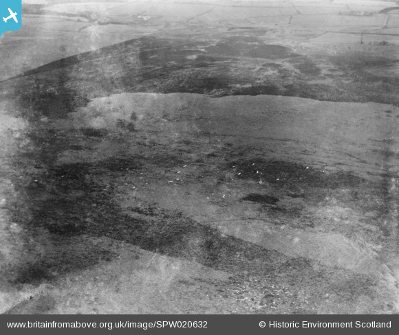
SPW020632 SCOTLAND (1928) [Unlocated]. Unlocated moorland. An oblique aerial photograph.
© Copyright OpenStreetMap contributors and licensed by the OpenStreetMap Foundation. 2025. Cartography is licensed as CC BY-SA.
Nearby Images (48)
Details
| Title | [SPW020632] Unlocated moorland. An oblique aerial photograph. |
| Reference | SPW020632 |
| Date | 1928 |
| Link | Canmore Collection item 1256390 |
| Place name | |
| Parish | |
| District | |
| Country | SCOTLAND |
| Easting / Northing | 0, 0 |
| Longitude / Latitude | -7.556448482059, 49.766185796754 |
| National Grid Reference | SV000000 |
Pins
Be the first to add a comment to this image!
User Comment Contributions
This photo follows one which is believed to be located to the Southeast of Cumbernauld. This may narrow down the search area. Good hunting! |
 Class31 |
Wednesday 25th of July 2012 11:26:06 AM |


![[EPW000143] UNLOCATED](http://britainfromabove.org.uk/sites/all/libraries/aerofilms-images/public/100x100/EPW/000/EPW000143.jpg)
![[EPW000667] Vessel at Sea](http://britainfromabove.org.uk/sites/all/libraries/aerofilms-images/public/100x100/EPW/000/EPW000667.jpg)
![[EPW005260] UNLOCATED](http://britainfromabove.org.uk/sites/all/libraries/aerofilms-images/public/100x100/EPW/005/EPW005260.jpg)
![[EPW006389] The R33 airship in flight over the Epsom Downs (unlocated), 1921](http://britainfromabove.org.uk/sites/all/libraries/aerofilms-images/public/100x100/EPW/006/EPW006389.jpg)
![[EPW007181] UNLOCATED](http://britainfromabove.org.uk/sites/all/libraries/aerofilms-images/public/100x100/EPW/007/EPW007181.jpg)
![[EPW015853] Cloudscape, 1926](http://britainfromabove.org.uk/sites/all/libraries/aerofilms-images/public/100x100/EPW/015/EPW015853.jpg)
![[EPW015854] Cloudscape, 1926](http://britainfromabove.org.uk/sites/all/libraries/aerofilms-images/public/100x100/EPW/015/EPW015854.jpg)
![[EPW015855] Cloudscape, 1926](http://britainfromabove.org.uk/sites/all/libraries/aerofilms-images/public/100x100/EPW/015/EPW015855.jpg)
![[EPW016012] UNLOCATED](http://britainfromabove.org.uk/sites/all/libraries/aerofilms-images/public/100x100/EPW/016/EPW016012.jpg)
![[EPW016510] Cloudscape, 1926](http://britainfromabove.org.uk/sites/all/libraries/aerofilms-images/public/100x100/EPW/016/EPW016510.jpg)
![[EPW016641] EPW016641](http://britainfromabove.org.uk/sites/all/libraries/aerofilms-images/public/100x100/EPW/016/EPW016641.jpg)
![[EPW017028] Cloudscape, 1926](http://britainfromabove.org.uk/sites/all/libraries/aerofilms-images/public/100x100/EPW/017/EPW017028.jpg)
![[EPW017029] Cloudscape, 1926](http://britainfromabove.org.uk/sites/all/libraries/aerofilms-images/public/100x100/EPW/017/EPW017029.jpg)
![[EPW017136] A vessel at sea off Beachy Head, from the east, 1926](http://britainfromabove.org.uk/sites/all/libraries/aerofilms-images/public/100x100/EPW/017/EPW017136.jpg)
![[SAW003585] Skiddaw, Lake District. Oblique aerial photograph.](http://britainfromabove.org.uk/sites/all/libraries/aerofilms-images/public/100x100/SAW/003/SAW003585.jpg)
![[SAW003586] Unlocated mountains, possibly near Ben Nevis. An oblique aerial photograph.](http://britainfromabove.org.uk/sites/all/libraries/aerofilms-images/public/100x100/SAW/003/SAW003586.jpg)
![[SAW009337] Wigtown Bay, general view, showing Ringdoo Point. An oblique aerial photograph taken facing west.](http://britainfromabove.org.uk/sites/all/libraries/aerofilms-images/public/100x100/SAW/009/SAW009337.jpg)
![[SAW009800] Clouds. An oblique aerial photograph.](http://britainfromabove.org.uk/sites/all/libraries/aerofilms-images/public/100x100/SAW/009/SAW009800.jpg)
![[SAW009801] Clouds. An oblique aerial photograph.](http://britainfromabove.org.uk/sites/all/libraries/aerofilms-images/public/100x100/SAW/009/SAW009801.jpg)
![[SAW009802] Unlocated, Scotland, 1947. An oblique Aerial photograph.](http://britainfromabove.org.uk/sites/all/libraries/aerofilms-images/public/100x100/SAW/009/SAW009802.jpg)
![[SAW010734] Clouds. An oblique aerial photograph.](http://britainfromabove.org.uk/sites/all/libraries/aerofilms-images/public/100x100/SAW/010/SAW010734.jpg)
![[SAW014737] Dalliefour Wood and River Dee, Balmoral Estate. An oblique aerial photograph taken facing east.](http://britainfromabove.org.uk/sites/all/libraries/aerofilms-images/public/100x100/SAW/014/SAW014737.jpg)
![[SAW017926] Unlocated image of haymaking, Dunbartonshire. An oblique aerial photograph.](http://britainfromabove.org.uk/sites/all/libraries/aerofilms-images/public/100x100/SAW/017/SAW017926.jpg)
![[SAW017927] Loch Ard Forest, general view showing Beinn Bhreac, Loch Ard and Ben Venue. An oblique aerial photograph taken facing north-east. This image has been produced from a damaged negative.](http://britainfromabove.org.uk/sites/all/libraries/aerofilms-images/public/100x100/SAW/017/SAW017927.jpg)
![[SAW032504] Unlocated country house, possibly near Ardanaiseig. Oblique aerial photograph. This image has been produced from a crop marked negative.](http://britainfromabove.org.uk/sites/all/libraries/aerofilms-images/public/100x100/SAW/032/SAW032504.jpg)
![[SPW020275] Scottish Dyes Ltd. Works, Grangemouth. An oblique aerial photograph taken facing north-west.](http://britainfromabove.org.uk/sites/all/libraries/aerofilms-images/public/100x100/SPW/020/SPW020275.jpg)
![[SPW020280] Birds flying low between Grangemouth and Culross, Firth of Forth. An oblique aerial photograph.](http://britainfromabove.org.uk/sites/all/libraries/aerofilms-images/public/100x100/SPW/020/SPW020280.jpg)
![[SPW020281] Birds flying low between Grangemouth and Culross, Firth of Forth. An oblique aerial photograph.](http://britainfromabove.org.uk/sites/all/libraries/aerofilms-images/public/100x100/SPW/020/SPW020281.jpg)
![[SPW020284] Ochil Hills, general view, showing Carsebreck Loch and Lower and Upper Rhynd Reservoirs. An oblique aerial photograph taken facing north-west.](http://britainfromabove.org.uk/sites/all/libraries/aerofilms-images/public/100x100/SPW/020/SPW020284.jpg)
![[SPW020632] Unlocated moorland. An oblique aerial photograph.](http://britainfromabove.org.uk/sites/all/libraries/aerofilms-images/public/100x100/SPW/020/SPW020632.jpg)
![[SPW020633] Unlocated moorland. An oblique aerial photograph.](http://britainfromabove.org.uk/sites/all/libraries/aerofilms-images/public/100x100/SPW/020/SPW020633.jpg)
![[SPW027083] Unlocated hills in Peeblesshire. An oblique aerial photograph.](http://britainfromabove.org.uk/sites/all/libraries/aerofilms-images/public/100x100/SPW/027/SPW027083.jpg)
![[SPW049776] Queen Mary, Firth of Clyde. An oblique aerial photograph.](http://britainfromabove.org.uk/sites/all/libraries/aerofilms-images/public/100x100/SPW/049/SPW049776.jpg)
![[SPW049777] Queen Mary, Firth of Clyde. An oblique aerial photograph.](http://britainfromabove.org.uk/sites/all/libraries/aerofilms-images/public/100x100/SPW/049/SPW049777.jpg)
![[SPW049779] Queen Mary, Firth of Clyde. An oblique aerial photograph.](http://britainfromabove.org.uk/sites/all/libraries/aerofilms-images/public/100x100/SPW/049/SPW049779.jpg)
![[SPW049783] Queen Mary, Firth of Clyde. An oblique aerial photograph.](http://britainfromabove.org.uk/sites/all/libraries/aerofilms-images/public/100x100/SPW/049/SPW049783.jpg)
![[SPW049791] Queen Mary, River Clyde. An oblique aerial photograph.](http://britainfromabove.org.uk/sites/all/libraries/aerofilms-images/public/100x100/SPW/049/SPW049791.jpg)
![[SPW049798] Queen Mary, Firth of Clyde. An oblique aerial photograph.](http://britainfromabove.org.uk/sites/all/libraries/aerofilms-images/public/100x100/SPW/049/SPW049798.jpg)
![[SPW049801] Queen Mary, Firth of Clyde. An oblique aerial photograph.](http://britainfromabove.org.uk/sites/all/libraries/aerofilms-images/public/100x100/SPW/049/SPW049801.jpg)
![[SPW049827] Queen Mary, Firth of Clyde. Speed trials. An oblique aerial photograph. This image has been produced from a damaged negative.](http://britainfromabove.org.uk/sites/all/libraries/aerofilms-images/public/100x100/SPW/049/SPW049827.jpg)
![[SPW049828] Queen Mary, Firth of Clyde. Speed trials. An oblique aerial photograph. This image has been produced from a damaged negative.](http://britainfromabove.org.uk/sites/all/libraries/aerofilms-images/public/100x100/SPW/049/SPW049828.jpg)
![[SPW049831] Queen Mary, Firth of Clyde. Speed trials. An oblique aerial photograph. This image has been produced from a damaged negative.](http://britainfromabove.org.uk/sites/all/libraries/aerofilms-images/public/100x100/SPW/049/SPW049831.jpg)
![[SPW049832] Queen Mary, Firth of Clyde. Speed trials. An oblique aerial photograph.](http://britainfromabove.org.uk/sites/all/libraries/aerofilms-images/public/100x100/SPW/049/SPW049832.jpg)
![[SPW049834] Queen Mary, Firth of Clyde. Speed trials. An oblique aerial photograph.](http://britainfromabove.org.uk/sites/all/libraries/aerofilms-images/public/100x100/SPW/049/SPW049834.jpg)
![[SPW049948] Queen Mary, Firth of Clyde. Speed trials. An oblique aerial photograph.](http://britainfromabove.org.uk/sites/all/libraries/aerofilms-images/public/100x100/SPW/049/SPW049948.jpg)
![[SPW049949] Queen Mary, Firth of Clyde. Speed trials. An oblique aerial photograph.](http://britainfromabove.org.uk/sites/all/libraries/aerofilms-images/public/100x100/SPW/049/SPW049949.jpg)
![[SPW051009] Unlocated area within the Glenapp Estate. An oblique aerial photograph.](http://britainfromabove.org.uk/sites/all/libraries/aerofilms-images/public/100x100/SPW/051/SPW051009.jpg)
![[SPW062638] Unlocated countryside. An oblique aerial photograph.](http://britainfromabove.org.uk/sites/all/libraries/aerofilms-images/public/100x100/SPW/062/SPW062638.jpg)