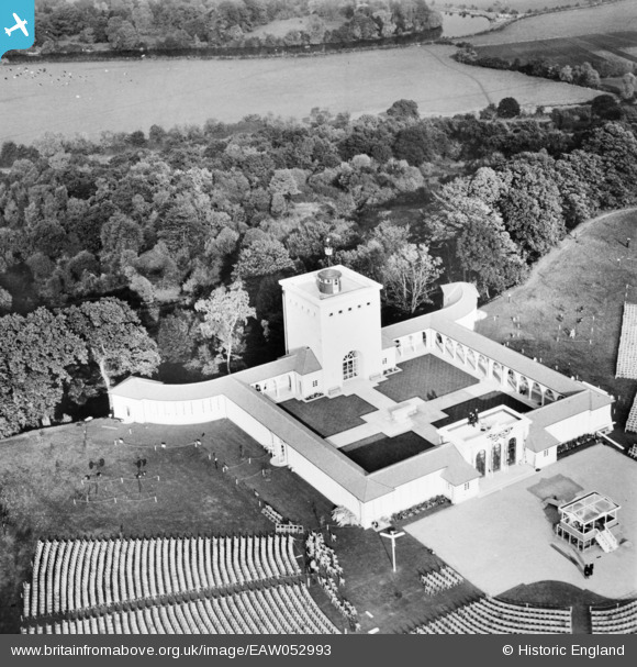
EAW052993 ENGLAND (1953). The Air Forces Memorial, Englefield Green, 1953
© Copyright OpenStreetMap contributors and licensed by the OpenStreetMap Foundation. 2024. Cartography is licensed as CC BY-SA.
Nearby Images (8)
Details
| Title | [EAW052993] The Air Forces Memorial, Englefield Green, 1953 |
| Reference | EAW052993 |
| Date | 19-November-1953 |
| Link | |
| Place name | ENGLEFIELD GREEN |
| Parish | |
| District | |
| Country | ENGLAND |
| Easting / Northing | 499844, 171972 |
| Longitude / Latitude | -0.5633840614731, 51.437444499452 |
| National Grid Reference | SU998720 |
Pins
Be the first to add a comment to this image!


![[EAW052993] The Air Forces Memorial, Englefield Green, 1953](http://britainfromabove.org.uk/sites/all/libraries/aerofilms-images/public/100x100/EAW/052/EAW052993.jpg)
![[EAW052838] Rows of seats positioned in readiness for the unveiling of the Air Forces Memorial, Cooper's Hill, 1953](http://britainfromabove.org.uk/sites/all/libraries/aerofilms-images/public/100x100/EAW/052/EAW052838.jpg)
![[EAW052840] Rows of seats positioned in readiness for the unveiling of the Air Forces Memorial, Cooper's Hill, 1953](http://britainfromabove.org.uk/sites/all/libraries/aerofilms-images/public/100x100/EAW/052/EAW052840.jpg)
![[EAW052841] Rows of seats positioned in readiness for the unveiling of the Air Forces Memorial, Cooper's Hill, from the south-east, 1953](http://britainfromabove.org.uk/sites/all/libraries/aerofilms-images/public/100x100/EAW/052/EAW052841.jpg)
![[EAW052839] Rows of seats positioned in readiness for the unveiling of the Air Forces Memorial, Cooper's Hill, from the south-east, 1953](http://britainfromabove.org.uk/sites/all/libraries/aerofilms-images/public/100x100/EAW/052/EAW052839.jpg)
![[EAW052836] Preparations underway the day before the unveiling of the Air Forces Memorial, Cooper's Hill, 1953](http://britainfromabove.org.uk/sites/all/libraries/aerofilms-images/public/100x100/EAW/052/EAW052836.jpg)
![[EAW052837] Preparations underway the day before the unveiling of the Air Forces Memorial, Cooper's Hill, 1953](http://britainfromabove.org.uk/sites/all/libraries/aerofilms-images/public/100x100/EAW/052/EAW052837.jpg)
![[EPW023509] Kingswood, Egham, 1928](http://britainfromabove.org.uk/sites/all/libraries/aerofilms-images/public/100x100/EPW/023/EPW023509.jpg)