
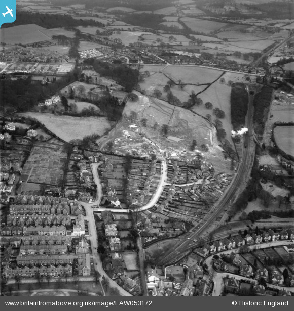
EAW053172 ENGLAND (1954). Banner Farm Estate in the early stages of construction, Royal Tunbridge Wells, 1954
© Copyright OpenStreetMap contributors and licensed by the OpenStreetMap Foundation. 2025. Cartography is licensed as CC BY-SA.
Nearby Images (21)
EAW053172

EAW053168

EAW053173

EAW053174

EAW053169

EAW053176

EAW053175

EPW032966

EAW053170

EPW032971

EPW032960

EPW032964

EAW053167

EPW032959

EPW032962

EPW032965

EPW032963

EPW032968

EPW032961

EPW032967

EAW053171

Details
| Title | [EAW053172] Banner Farm Estate in the early stages of construction, Royal Tunbridge Wells, 1954 |
| Reference | EAW053172 |
| Date | 22-February-1954 |
| Link | |
| Place name | ROYAL TUNBRIDGE WELLS |
| Parish | |
| District | |
| Country | ENGLAND |
| Easting / Northing | 558917, 138666 |
| Longitude / Latitude | 0.27119049732024, 51.124675015015 |
| National Grid Reference | TQ589387 |
Pins
 redmist |
Sunday 21st of November 2021 02:52:31 PM | |
redmist |
Sunday 21st of November 2021 02:52:07 PM | |
John Wass |
Sunday 12th of April 2015 11:57:13 AM | |
John Wass |
Sunday 12th of April 2015 11:56:14 AM | |
John Wass |
Sunday 12th of April 2015 11:54:07 AM |