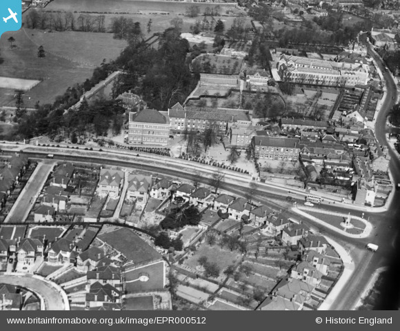
EPR000512 ENGLAND (1935). St Joseph's R.C. Convent Schools, Hendon, 1935
© Copyright OpenStreetMap contributors and licensed by the OpenStreetMap Foundation. 2024. Cartography is licensed as CC BY-SA.
Details
| Title | [EPR000512] St Joseph's R.C. Convent Schools, Hendon, 1935 |
| Reference | EPR000512 |
| Date | 1935 |
| Link | |
| Place name | HENDON |
| Parish | |
| District | |
| Country | ENGLAND |
| Easting / Northing | 522591, 189043 |
| Longitude / Latitude | -0.23030110645358, 51.586415895089 |
| National Grid Reference | TQ226890 |
Pins
 Digitalsnapper |
Monday 8th of August 2016 12:13:39 PM | |
 Digitalsnapper |
Monday 8th of August 2016 12:06:04 PM | |
 Digitalsnapper |
Monday 8th of August 2016 12:06:03 PM |


![[EPR000512] St Joseph's R.C. Convent Schools, Hendon, 1935](http://britainfromabove.org.uk/sites/all/libraries/aerofilms-images/public/100x100/EPR/000/EPR000512.jpg)
![[EPW031653] Watford Way and Central Circus, Hendon, from the north-west, 1930](http://britainfromabove.org.uk/sites/all/libraries/aerofilms-images/public/100x100/EPW/031/EPW031653.jpg)
![[EPW011877] The Burroughs and environs, Hendon, 1924. This image has been produced from a copy-negative.](http://britainfromabove.org.uk/sites/all/libraries/aerofilms-images/public/100x100/EPW/011/EPW011877.jpg)
![[EPW006779] Laundry near the St Joseph's R.C. Convent Schools, Hendon, 1921](http://britainfromabove.org.uk/sites/all/libraries/aerofilms-images/public/100x100/EPW/006/EPW006779.jpg)