
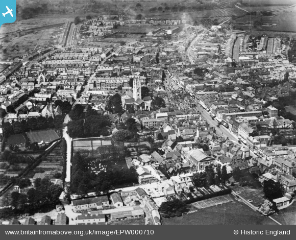
EPW000710 ENGLAND (1920). The town centre, Ashford, 1920. This image has been produced from a copy negative.
© Copyright OpenStreetMap contributors and licensed by the OpenStreetMap Foundation. 2025. Cartography is licensed as CC BY-SA.
Nearby Images (12)
EPW000710

EPW009142

EPW026089

EPW026086

EPW009218

EPW007035

EPW001440

EPW026091

EPW026096

EPW026100

EPW009217

EPW026088

Details
| Title | [EPW000710] The town centre, Ashford, 1920. This image has been produced from a copy negative. |
| Reference | EPW000710 |
| Date | April-1920 |
| Link | |
| Place name | ASHFORD |
| Parish | |
| District | |
| Country | ENGLAND |
| Easting / Northing | 601057, 142737 |
| Longitude / Latitude | 0.87498702839477, 51.148001541845 |
| National Grid Reference | TR011427 |
Pins
Be the first to add a comment to this image!