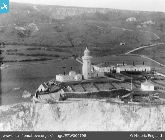
EPW000798 ENGLAND (1920). St Catherine's Lighthouse, St Catherine's Point, 1920
© Copyright OpenStreetMap contributors and licensed by the OpenStreetMap Foundation. 2025. Cartography is licensed as CC BY-SA.
Nearby Images (9)
Details
| Title | [EPW000798] St Catherine's Lighthouse, St Catherine's Point, 1920 |
| Reference | EPW000798 |
| Date | April-1920 |
| Link | |
| Place name | ST CATHERINE'S POINT |
| Parish | NITON AND WHITWELL |
| District | |
| Country | ENGLAND |
| Easting / Northing | 449807, 75339 |
| Longitude / Latitude | -1.2965256855878, 50.575077004716 |
| National Grid Reference | SZ498753 |
Pins
Be the first to add a comment to this image!


![[EPW000798] St Catherine's Lighthouse, St Catherine's Point, 1920](http://britainfromabove.org.uk/sites/all/libraries/aerofilms-images/public/100x100/EPW/000/EPW000798.jpg)
![[EPW023086] St Catherine's Lighthouse and Knowles, St Catherine's Point, 1928](http://britainfromabove.org.uk/sites/all/libraries/aerofilms-images/public/100x100/EPW/023/EPW023086.jpg)
![[EPW023090] St. Catherine's Lighthouse, St Catherine's Point, 1928](http://britainfromabove.org.uk/sites/all/libraries/aerofilms-images/public/100x100/EPW/023/EPW023090.jpg)
![[EAW038598] Knowles Farm and St Catherine's Lighthouse, St Catherine's Point, 1951. This image has been produced from a print.](http://britainfromabove.org.uk/sites/all/libraries/aerofilms-images/public/100x100/EAW/038/EAW038598.jpg)
![[EPW000504] St Catherine's Lighthouse, St Catherine's Point, Isle of Wight, 1920](http://britainfromabove.org.uk/sites/all/libraries/aerofilms-images/public/100x100/EPW/000/EPW000504.jpg)
![[EPW039632] St Catherine's Lighthouse and the coastline, St Catherine's Point, from the south-west, 1932](http://britainfromabove.org.uk/sites/all/libraries/aerofilms-images/public/100x100/EPW/039/EPW039632.jpg)
![[EPW023087] St Catherine's Lighthouse, St Catherine's Point, 1928](http://britainfromabove.org.uk/sites/all/libraries/aerofilms-images/public/100x100/EPW/023/EPW023087.jpg)
![[EAW038599] Knowles Farm, St Catherine's Lighthouse and the surrounding area, St Catherine's Point, from the south-west, 1951. This image has been produced from a print.](http://britainfromabove.org.uk/sites/all/libraries/aerofilms-images/public/100x100/EAW/038/EAW038599.jpg)
![[EPW000506] St Catherine's Lighthouse, St Catherine's Point, Isle of Wight, from the south, 1920](http://britainfromabove.org.uk/sites/all/libraries/aerofilms-images/public/100x100/EPW/000/EPW000506.jpg)