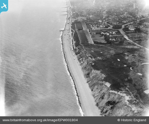
EPW001804 ENGLAND (1920). The Grand Hotel, Golf course and The Promenade, Sheringham, 1920
© Copyright OpenStreetMap contributors and licensed by the OpenStreetMap Foundation. 2025. Cartography is licensed as CC BY-SA.
Details
| Title | [EPW001804] The Grand Hotel, Golf course and The Promenade, Sheringham, 1920 |
| Reference | EPW001804 |
| Date | June-1920 |
| Link | |
| Place name | SHERINGHAM |
| Parish | SHERINGHAM |
| District | |
| Country | ENGLAND |
| Easting / Northing | 615360, 343569 |
| Longitude / Latitude | 1.2058030823628, 52.945898596193 |
| National Grid Reference | TG154436 |
Pins
User Comment Contributions
here there was a hand operated winch for pulling the crab boats up the beach and shingle |
 Farrowbee |
Friday 21st of August 2015 06:36:40 PM |
 royalfixit |
Wednesday 27th of June 2012 05:47:03 AM |


![[EPW001804] The Grand Hotel, Golf course and The Promenade, Sheringham, 1920](http://britainfromabove.org.uk/sites/all/libraries/aerofilms-images/public/100x100/EPW/001/EPW001804.jpg)
![[EAW051656] The town, the seafront and the surrounding coastline, Sheringham, from the west, 1953](http://britainfromabove.org.uk/sites/all/libraries/aerofilms-images/public/100x100/EAW/051/EAW051656.jpg)
![[EPW021201] The Grand Hotel, Sheringham, 1928](http://britainfromabove.org.uk/sites/all/libraries/aerofilms-images/public/100x100/EPW/021/EPW021201.jpg)
![[EPW001805] The Grand Hotel and Esplanade, Sheringham, 1920](http://britainfromabove.org.uk/sites/all/libraries/aerofilms-images/public/100x100/EPW/001/EPW001805.jpg)

