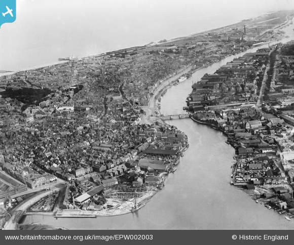
EPW002003 ENGLAND (1920). General view of the town, Great Yarmouth, from the north-west, 1920
© Copyright OpenStreetMap contributors and licensed by the OpenStreetMap Foundation. 2025. Cartography is licensed as CC BY-SA.
Nearby Images (6)
Details
| Title | [EPW002003] General view of the town, Great Yarmouth, from the north-west, 1920 |
| Reference | EPW002003 |
| Date | June-1920 |
| Link | |
| Place name | GREAT YARMOUTH |
| Parish | |
| District | |
| Country | ENGLAND |
| Easting / Northing | 652208, 307537 |
| Longitude / Latitude | 1.7253905431356, 52.606596770019 |
| National Grid Reference | TG522075 |
Pins
 redmist |
Wednesday 19th of January 2022 07:00:52 PM | |
 Brigham |
Tuesday 18th of April 2017 11:45:35 AM | |
 Brigham |
Tuesday 18th of April 2017 11:44:54 AM | |
 norfolkadam |
Tuesday 21st of February 2017 06:47:46 PM | |
 Dean Duneclift |
Monday 9th of January 2017 10:42:50 AM | |
 SA1758 |
Saturday 27th of February 2016 05:10:37 PM | |
 GlenDenny53 |
Monday 9th of June 2014 01:45:30 PM | |
 c.c |
Monday 16th of September 2013 03:22:51 PM | |
 c.c |
Friday 10th of August 2012 02:31:20 PM |


![[EPW002003] General view of the town, Great Yarmouth, from the north-west, 1920](http://britainfromabove.org.uk/sites/all/libraries/aerofilms-images/public/100x100/EPW/002/EPW002003.jpg)
![[EAW052972] Haven Bridge, Hall Quay and the old town centre, Great Yarmouth, 1953](http://britainfromabove.org.uk/sites/all/libraries/aerofilms-images/public/100x100/EAW/052/EAW052972.jpg)
![[EPW021191] Hall Quay and the Town Hall, Great Yarmouth, 1928](http://britainfromabove.org.uk/sites/all/libraries/aerofilms-images/public/100x100/EPW/021/EPW021191.jpg)
![[EPW001878] Southtown Bridge area, Great Yarmouth, 1920](http://britainfromabove.org.uk/sites/all/libraries/aerofilms-images/public/100x100/EPW/001/EPW001878.jpg)
![[EAW052976] Regent Street and environs, Great Yarmouth, 1953](http://britainfromabove.org.uk/sites/all/libraries/aerofilms-images/public/100x100/EAW/052/EAW052976.jpg)
![[EAW052975] The River Yare at Haven Bridge and the Breydon Viaduct, Great Yarmouth, from the south-east, 1953](http://britainfromabove.org.uk/sites/all/libraries/aerofilms-images/public/100x100/EAW/052/EAW052975.jpg)