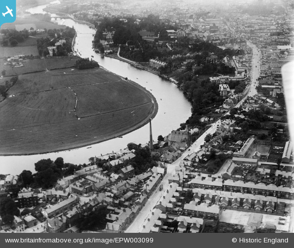
EPW003099 ENGLAND (1920). Earl's Eye, Chester, 1920
© Copyright OpenStreetMap contributors and licensed by the OpenStreetMap Foundation. 2024. Cartography is licensed as CC BY-SA.
Details
| Title | [EPW003099] Earl's Eye, Chester, 1920 |
| Reference | EPW003099 |
| Date | July-1920 |
| Link | |
| Place name | CHESTER |
| Parish | |
| District | |
| Country | ENGLAND |
| Easting / Northing | 341696, 366363 |
| Longitude / Latitude | -2.8727245518393, 53.190869435959 |
| National Grid Reference | SJ417664 |
Pins
 John Wass |
Saturday 15th of April 2017 07:31:42 PM | |
 SimonP |
Thursday 24th of July 2014 11:12:17 AM | |
 rmarah |
Thursday 28th of June 2012 05:53:04 PM | |
 rmarah |
Thursday 28th of June 2012 05:52:26 PM | |
 rmarah |
Thursday 28th of June 2012 05:49:05 PM |


![[EPW003099] Earl's Eye, Chester, 1920](http://britainfromabove.org.uk/sites/all/libraries/aerofilms-images/public/100x100/EPW/003/EPW003099.jpg)
![[EPW036914] Chester Water Works and environs, Boughton, 1931](http://britainfromabove.org.uk/sites/all/libraries/aerofilms-images/public/100x100/EPW/036/EPW036914.jpg)
![[EPW003096] The Water Works, Earl's Eye and the River Dee, Chester, from the north-east, 1920. This image has been produced from a print.](http://britainfromabove.org.uk/sites/all/libraries/aerofilms-images/public/100x100/EPW/003/EPW003096.jpg)
![[EPW037221] Boughton and Hoole, Chester, 1931. This image has been produced from a print.](http://britainfromabove.org.uk/sites/all/libraries/aerofilms-images/public/100x100/EPW/037/EPW037221.jpg)