
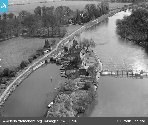
EPW005736 ENGLAND (1921). Bray Lock, Bray, 1921
© Copyright OpenStreetMap contributors and licensed by the OpenStreetMap Foundation. 2025. Cartography is licensed as CC BY-SA.
Nearby Images (6)
EPW005736

EPW005735

EPW036180

EAW017992

EAW017991

EPW037507

Details
| Title | [EPW005736] Bray Lock, Bray, 1921 |
| Reference | EPW005736 |
| Date | March-1921 |
| Link | |
| Place name | BRAY |
| Parish | BRAY |
| District | |
| Country | ENGLAND |
| Easting / Northing | 490937, 179731 |
| Longitude / Latitude | -0.68950817801915, 51.508699650323 |
| National Grid Reference | SU909797 |
Pins
Be the first to add a comment to this image!
User Comment Contributions
This looks like Bray Lock taken from the NW |
 Andy |
Friday 13th of July 2012 05:38:31 PM |
Spot on Andy |
bahrainrover |
Tuesday 26th of June 2012 12:08:56 PM |
I agree completely, that is Bray Lock |
Jeff |
Friday 13th of July 2012 05:38:31 PM |
Dear Andy and bahrainrover, That’s great; as for EPW005735, we'll update the catalogue and the revised record will appear here in due course. Thanks for your help. Katy Whitaker Britain from Above Cataloguer |
Katy Whitaker |
Monday 2nd of July 2012 01:54:24 PM |