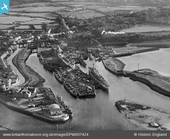
EPW007424 ENGLAND (1921). The harbour, Hayle, 1921. This image has been produced from a copy-negative.
© Copyright OpenStreetMap contributors and licensed by the OpenStreetMap Foundation. 2025. Cartography is licensed as CC BY-SA.
Nearby Images (9)
EPW007424

EPW007419

EAW030939

EAW030936

EAW030942

EPW059856

EAW030934

EAW030935

EAW030937

Details
| Title | [EPW007424] The harbour, Hayle, 1921. This image has been produced from a copy-negative. |
| Reference | EPW007424 |
| Date | 10-November-1921 |
| Link | |
| Place name | HAYLE |
| Parish | HAYLE |
| District | |
| Country | ENGLAND |
| Easting / Northing | 155677, 37419 |
| Longitude / Latitude | -5.4230315256889, 50.185690832471 |
| National Grid Reference | SW557374 |
Pins
Be the first to add a comment to this image!