
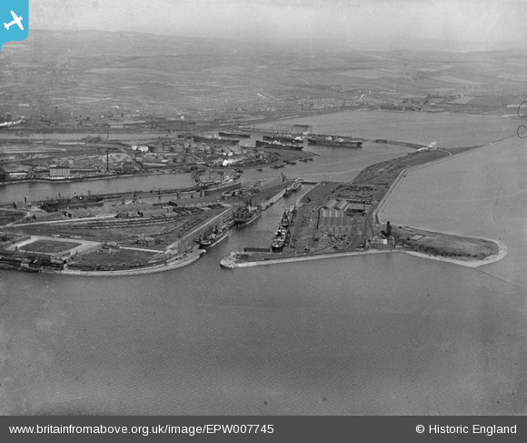
EPW007745 ENGLAND (1922). The docks, Barrow-in-Furness, from the south-west, 1922
© Copyright OpenStreetMap contributors and licensed by the OpenStreetMap Foundation. 2025. Cartography is licensed as CC BY-SA.
Nearby Images (5)
EPW007745

EPW007742

EPW007746

EPW004066

EPW007747

Details
| Title | [EPW007745] The docks, Barrow-in-Furness, from the south-west, 1922 |
| Reference | EPW007745 |
| Date | April-1922 |
| Link | |
| Place name | BARROW-IN-FURNESS |
| Parish | |
| District | |
| Country | ENGLAND |
| Easting / Northing | 320015, 467083 |
| Longitude / Latitude | -3.2231037331998, 54.093246001879 |
| National Grid Reference | SD200671 |
Pins
 Matthew Culley |
Saturday 11th of April 2020 07:26:56 PM | |
Matthew Culley |
Sunday 29th of March 2020 07:44:16 PM | |
Matthew Culley |
Sunday 29th of March 2020 07:42:26 PM | |
Matthew Culley |
Sunday 29th of March 2020 07:02:36 PM | |
Matthew Culley |
Sunday 29th of March 2020 06:56:34 PM | |
Matthew Culley |
Sunday 29th of March 2020 06:55:00 PM | |
Matthew Culley |
Sunday 29th of March 2020 06:52:51 PM | |
Matthew Culley |
Sunday 29th of March 2020 06:52:18 PM | |
Matthew Culley |
Sunday 29th of March 2020 06:40:34 PM | |
Matthew Culley |
Sunday 29th of March 2020 06:36:20 PM |
User Comment Contributions
Oriole Terrace ? |
Islander |
Thursday 25th of October 2012 12:29:14 PM |