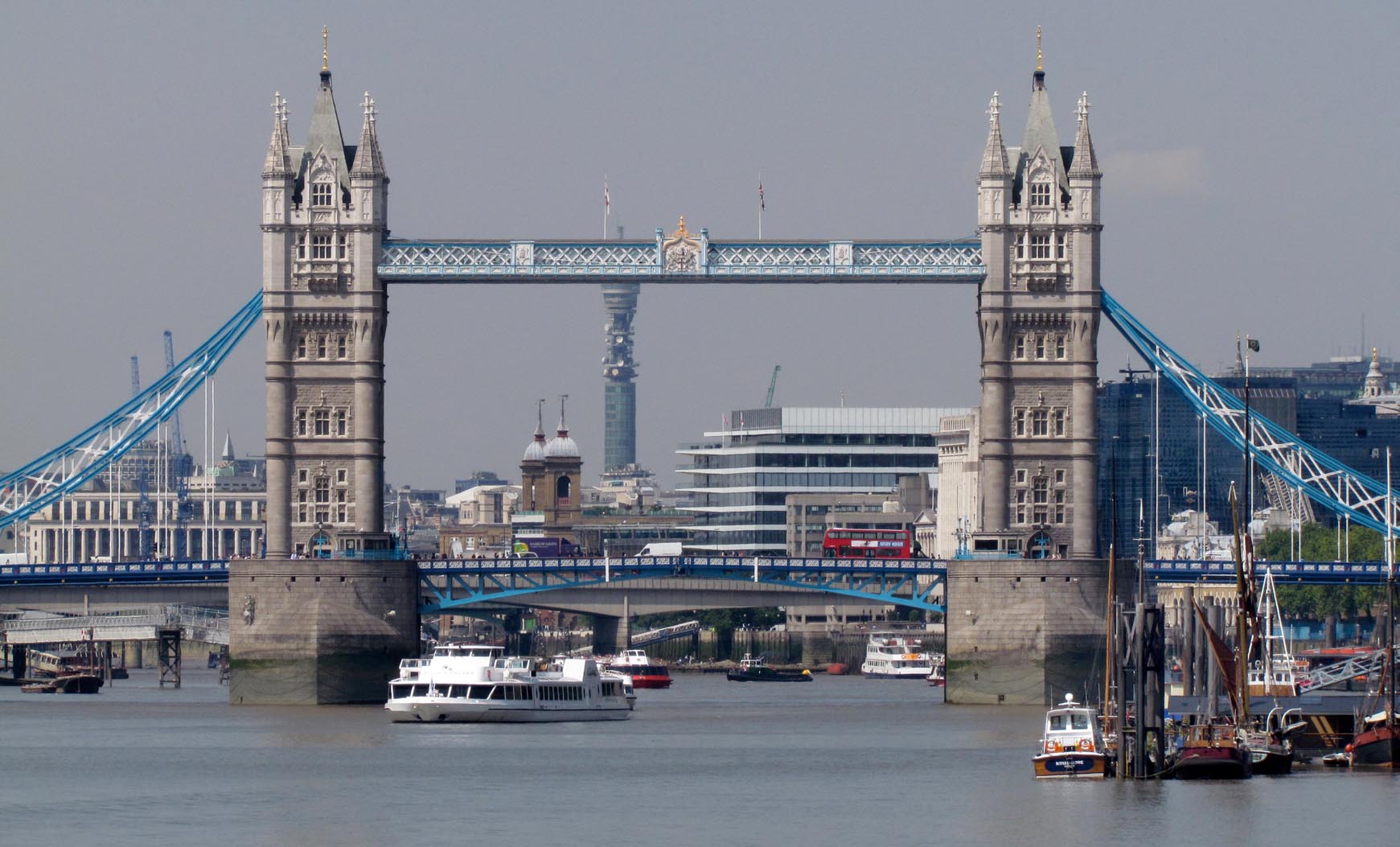
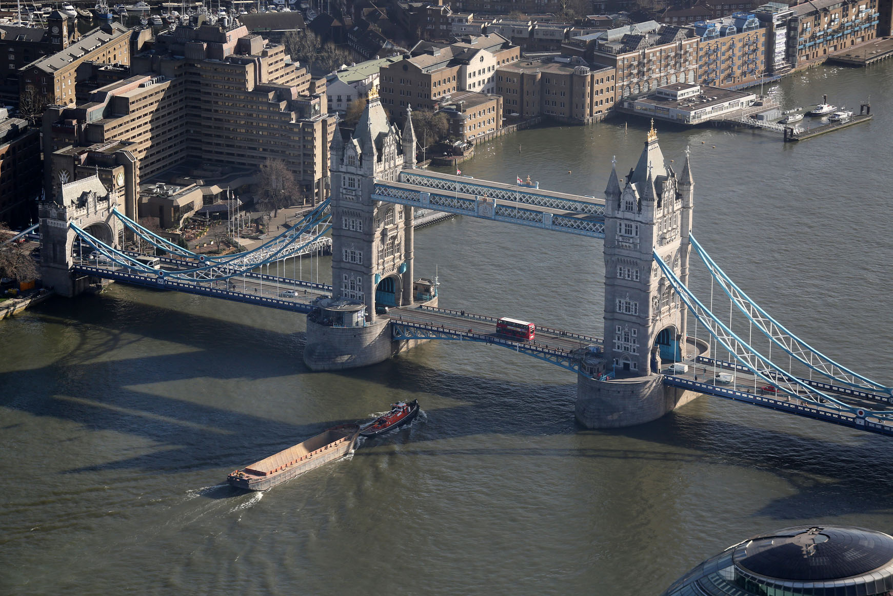
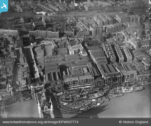
EPW007774 ENGLAND (1922). Mark Brown's Wharf, Potters Field and environs, Bermondsey, 1922
© Copyright OpenStreetMap contributors and licensed by the OpenStreetMap Foundation. 2025. Cartography is licensed as CC BY-SA.
Nearby Images (42)
Details
| Title | [EPW007774] Mark Brown's Wharf, Potters Field and environs, Bermondsey, 1922 |
| Reference | EPW007774 |
| Date | 13-May-1922 |
| Link | |
| Place name | BERMONDSEY |
| Parish | |
| District | |
| Country | ENGLAND |
| Easting / Northing | 533508, 180093 |
| Longitude / Latitude | -0.07619372512152, 51.503497941014 |
| National Grid Reference | TQ335801 |
Pins
 Leslie B |
Monday 7th of March 2016 07:46:41 PM | |
 brianbeckett |
Saturday 4th of October 2014 10:06:16 PM | |
 Alan McFaden |
Monday 25th of August 2014 11:45:20 AM | |
 Alan McFaden |
Friday 18th of July 2014 12:28:52 PM | |
 Alan McFaden |
Wednesday 14th of August 2013 10:48:56 PM | |
 Alan McFaden |
Wednesday 7th of August 2013 09:47:55 AM | |
 Alan McFaden |
Tuesday 28th of May 2013 09:29:54 AM | |
 Alan McFaden |
Wednesday 17th of April 2013 04:06:55 PM | |
 Alan McFaden |
Wednesday 17th of April 2013 04:03:37 PM | |
 Alan McFaden |
Wednesday 17th of April 2013 04:02:54 PM | |
 Class31 |
Tuesday 22nd of January 2013 04:21:23 PM | |
 Class31 |
Tuesday 22nd of January 2013 04:20:29 PM | |
 Class31 |
Tuesday 22nd of January 2013 04:08:28 PM | |
 Class31 |
Tuesday 22nd of January 2013 04:06:22 PM | |
 EZTD |
Thursday 28th of June 2012 01:47:28 PM |
User Comment Contributions
 Leslie B |
Tuesday 8th of March 2016 07:04:17 PM | |
Tower Bridge from Hermitage Riverside Memorial Garden, 17/02/2015 |
 Class31 |
Wednesday 18th of February 2015 10:32:27 AM |
 Tower Bridge |
 Alan McFaden |
Wednesday 24th of December 2014 10:51:47 AM |
 The view from Tower Bridge 2014 |
 Alan McFaden |
Wednesday 24th of December 2014 10:51:18 AM |
 Tower Bridge |
 Alan McFaden |
Wednesday 24th of December 2014 10:50:43 AM |
 Tower Bridge |
 Alan McFaden |
Wednesday 24th of December 2014 10:50:14 AM |
Tower Bridge, 23/10/2014 |
 Class31 |
Wednesday 17th of December 2014 08:13:47 PM |
My paternal Grandfather was warehouseman at Mark Brown's Wharf in 1911 (recorded in census) |
 Alec_Jackson |
Saturday 28th of December 2013 10:18:52 PM |


![[EPW007774] Mark Brown's Wharf, Potters Field and environs, Bermondsey, 1922](http://britainfromabove.org.uk/sites/all/libraries/aerofilms-images/public/100x100/EPW/007/EPW007774.jpg)
![[EPW007767] Mark Brown's Wharf and Potters Field area, Bermondsey, 1922](http://britainfromabove.org.uk/sites/all/libraries/aerofilms-images/public/100x100/EPW/007/EPW007767.jpg)
![[EPW007768] Mark Brown's Wharf, Tower Bridge and Potters Field area, Bermondsey, 1922](http://britainfromabove.org.uk/sites/all/libraries/aerofilms-images/public/100x100/EPW/007/EPW007768.jpg)
![[EPW007772] Mark Brown's Wharf and environs, Bermondsey, 1922](http://britainfromabove.org.uk/sites/all/libraries/aerofilms-images/public/100x100/EPW/007/EPW007772.jpg)
![[EPW007773] Mark Brown's Wharf, Potters Field and environs, Bermondsey, 1922](http://britainfromabove.org.uk/sites/all/libraries/aerofilms-images/public/100x100/EPW/007/EPW007773.jpg)
![[EPW007765] Mark Brown's Wharf, Potters Field and environs, Bermondsey, 1922](http://britainfromabove.org.uk/sites/all/libraries/aerofilms-images/public/100x100/EPW/007/EPW007765.jpg)
![[EPW007775] Tower Bridge, Mark Brown's Wharf, Potters Field and environs, Bermondsey, 1922. This image has been produced from a damaged print.](http://britainfromabove.org.uk/sites/all/libraries/aerofilms-images/public/100x100/EPW/007/EPW007775.jpg)
![[EPW045435] The River Thames between London Bridge and Tower Bridge, Bermondsey, from the south-east, 1934](http://britainfromabove.org.uk/sites/all/libraries/aerofilms-images/public/100x100/EPW/045/EPW045435.jpg)
![[EPW007766] Mark Brown's Wharf and Tower Bridge, Bermondsey, 1922](http://britainfromabove.org.uk/sites/all/libraries/aerofilms-images/public/100x100/EPW/007/EPW007766.jpg)
![[EAW034860] Tower Bridge and the Tower of London, London, 1951. This image has been produced from a print.](http://britainfromabove.org.uk/sites/all/libraries/aerofilms-images/public/100x100/EAW/034/EAW034860.jpg)
![[EAW011130] Warehouses along Pickle Herring Street and Tower Bridge, Bermondsey, 1947. This image has been produced from a print.](http://britainfromabove.org.uk/sites/all/libraries/aerofilms-images/public/100x100/EAW/011/EAW011130.jpg)
![[EPW045441] The River Thames between Tower Bridge and Southwark Bridge, Bermondsey, from the east, 1934](http://britainfromabove.org.uk/sites/all/libraries/aerofilms-images/public/100x100/EPW/045/EPW045441.jpg)
![[EPW030091] Tower Bridge and the Tower of London, London, 1929](http://britainfromabove.org.uk/sites/all/libraries/aerofilms-images/public/100x100/EPW/030/EPW030091.jpg)
![[EAW035308] Tower Bridge, London, 1951. This image has been produced from a print.](http://britainfromabove.org.uk/sites/all/libraries/aerofilms-images/public/100x100/EAW/035/EAW035308.jpg)
![[EPW001603] Tower Bridge and the Tower of London, London, 1920](http://britainfromabove.org.uk/sites/all/libraries/aerofilms-images/public/100x100/EPW/001/EPW001603.jpg)
![[EAW029486] The River Thames from Tower Bridge to Westminster Bridge, London, from the east, 1950](http://britainfromabove.org.uk/sites/all/libraries/aerofilms-images/public/100x100/EAW/029/EAW029486.jpg)
![[EAW018709] Tower Bridge, the Anchor Brewhouse and Butler's Wharf, Bermondsey, 1948. This image has been produced from a print.](http://britainfromabove.org.uk/sites/all/libraries/aerofilms-images/public/100x100/EAW/018/EAW018709.jpg)
![[EPW045436] The River Thames between Tower Bridge and Southwark Bridge, Bermondsey, from the north-east, 1934](http://britainfromabove.org.uk/sites/all/libraries/aerofilms-images/public/100x100/EPW/045/EPW045436.jpg)
![[EPW030090] Tower Bridge and the Tower of London, London, 1929](http://britainfromabove.org.uk/sites/all/libraries/aerofilms-images/public/100x100/EPW/030/EPW030090.jpg)
![[EAW011149] Tower Bridge, London, 1947](http://britainfromabove.org.uk/sites/all/libraries/aerofilms-images/public/100x100/EAW/011/EAW011149.jpg)
![[EAW034863] Tower Bridge, London, 1951. This image has been produced from a print.](http://britainfromabove.org.uk/sites/all/libraries/aerofilms-images/public/100x100/EAW/034/EAW034863.jpg)
![[EPW030092] Tower Bridge, London, 1929](http://britainfromabove.org.uk/sites/all/libraries/aerofilms-images/public/100x100/EPW/030/EPW030092.jpg)
![[EAW031803] A boat passing through Tower Bridge, London, 1950](http://britainfromabove.org.uk/sites/all/libraries/aerofilms-images/public/100x100/EAW/031/EAW031803.jpg)
![[EAW036884] The River Thames and the City of London, London, from the south-east, 1951. This image has been produced from a print.](http://britainfromabove.org.uk/sites/all/libraries/aerofilms-images/public/100x100/EAW/036/EAW036884.jpg)
![[EAW031804] A boat passing through Tower Bridge, London, 1950](http://britainfromabove.org.uk/sites/all/libraries/aerofilms-images/public/100x100/EAW/031/EAW031804.jpg)
![[EPW005909] Tower Bridge, London, 1921. This image has been produced from a print.](http://britainfromabove.org.uk/sites/all/libraries/aerofilms-images/public/100x100/EPW/005/EPW005909.jpg)
![[EAW036885] The River Thames and the City of London, London, from the east, 1951. This image has been produced from a damaged print.](http://britainfromabove.org.uk/sites/all/libraries/aerofilms-images/public/100x100/EAW/036/EAW036885.jpg)
![[EAW021099] Tower Bridge, London, 1949. This image has been produced from a damaged negative.](http://britainfromabove.org.uk/sites/all/libraries/aerofilms-images/public/100x100/EAW/021/EAW021099.jpg)
![[EAW035306] Tower Bridge and the Tower of London, London, 1951. This image has been produced from a print.](http://britainfromabove.org.uk/sites/all/libraries/aerofilms-images/public/100x100/EAW/035/EAW035306.jpg)
![[EAW029484] Tower Bridge and the Tower of London looking towards St Paul's Cathedral and beyond, London, from the south-east, 1950](http://britainfromabove.org.uk/sites/all/libraries/aerofilms-images/public/100x100/EAW/029/EAW029484.jpg)
![[EPW037975] Tower Bridge, London, 1932](http://britainfromabove.org.uk/sites/all/libraries/aerofilms-images/public/100x100/EPW/037/EPW037975.jpg)
![[EAW034861] Tower Bridge, London, 1951. This image has been produced from a print.](http://britainfromabove.org.uk/sites/all/libraries/aerofilms-images/public/100x100/EAW/034/EAW034861.jpg)
![[EPW026870] The Tower of London and Tower Bridge, London, 1929](http://britainfromabove.org.uk/sites/all/libraries/aerofilms-images/public/100x100/EPW/026/EPW026870.jpg)
![[EPW005766] The Tower of London and Tower Bridge, London, 1921](http://britainfromabove.org.uk/sites/all/libraries/aerofilms-images/public/100x100/EPW/005/EPW005766.jpg)
![[EAW031801] A boat passing through Tower Bridge, London, 1950](http://britainfromabove.org.uk/sites/all/libraries/aerofilms-images/public/100x100/EAW/031/EAW031801.jpg)
![[EAW021098] Tower Bridge (site of), London, 1949. This image has been produced from a damaged negative.](http://britainfromabove.org.uk/sites/all/libraries/aerofilms-images/public/100x100/EAW/021/EAW021098.jpg)
![[EAW031802] A boat passing through Tower Bridge, London, 1950](http://britainfromabove.org.uk/sites/all/libraries/aerofilms-images/public/100x100/EAW/031/EAW031802.jpg)
![[EAW006476] Tower Bridge, St Katharine Docks and environs, London, 1947](http://britainfromabove.org.uk/sites/all/libraries/aerofilms-images/public/100x100/EAW/006/EAW006476.jpg)
![[EPW005602] Tower Bridge and the Tower of London, London, 1921](http://britainfromabove.org.uk/sites/all/libraries/aerofilms-images/public/100x100/EPW/005/EPW005602.jpg)
![[EAW034862] Tower Bridge, London, 1951. This image has been produced from a print.](http://britainfromabove.org.uk/sites/all/libraries/aerofilms-images/public/100x100/EAW/034/EAW034862.jpg)
![[EPW024278] Tower Bridge, London, 1928](http://britainfromabove.org.uk/sites/all/libraries/aerofilms-images/public/100x100/EPW/024/EPW024278.jpg)
![[EAW006474] Tower Bridge, St Katharine Docks and environs, London, 1947](http://britainfromabove.org.uk/sites/all/libraries/aerofilms-images/public/100x100/EAW/006/EAW006474.jpg)


_10.jpg?itok=6pd_bbbN)


