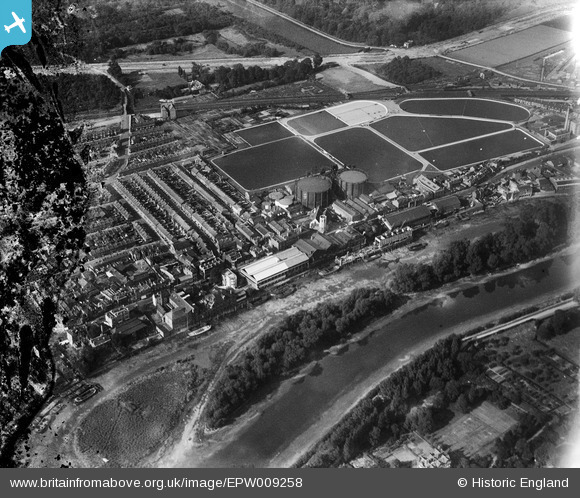
EPW009258 ENGLAND (1923). The Kew Bridge Water Works and environs, Brentford, 1923
© Copyright OpenStreetMap contributors and licensed by the OpenStreetMap Foundation. 2024. Cartography is licensed as CC BY-SA.
Details
| Title | [EPW009258] The Kew Bridge Water Works and environs, Brentford, 1923 |
| Reference | EPW009258 |
| Date | 1923 |
| Link | |
| Place name | BRENTFORD |
| Parish | |
| District | |
| Country | ENGLAND |
| Easting / Northing | 518416, 177833 |
| Longitude / Latitude | -0.29431271604416, 51.486548339701 |
| National Grid Reference | TQ184778 |
Pins
 Martin Devlin |
Monday 5th of October 2020 04:11:45 PM | |
 Leslie B |
Sunday 16th of July 2017 09:50:40 PM | |
 Isleworth1961 |
Tuesday 7th of May 2013 05:33:15 PM |


![[EPW009258] The Kew Bridge Water Works and environs, Brentford, 1923](http://britainfromabove.org.uk/sites/all/libraries/aerofilms-images/public/100x100/EPW/009/EPW009258.jpg)
![[EPW057064] Kew Bridge Water Works and environs, Brentford, 1938](http://britainfromabove.org.uk/sites/all/libraries/aerofilms-images/public/100x100/EPW/057/EPW057064.jpg)
![[EPW009265] The Kew Bridge Water Works and environs, Brentford, 1923. This image has been produced from a print.](http://britainfromabove.org.uk/sites/all/libraries/aerofilms-images/public/100x100/EPW/009/EPW009265.jpg)
![[EPW059939] Ealing Road and environs, Brentford, 1938. This image has been produced from a copy-negative.](http://britainfromabove.org.uk/sites/all/libraries/aerofilms-images/public/100x100/EPW/059/EPW059939.jpg)
