
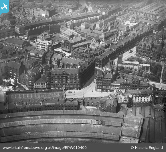
EPW010400 ENGLAND (1924). St John the Baptist's Church and Central Station, Newcastle upon Tyne, 1924
© Copyright OpenStreetMap contributors and licensed by the OpenStreetMap Foundation. 2025. Cartography is licensed as CC BY-SA.
Nearby Images (8)
EPW010400

EPW019821

EPW010398

EAW017456

EPW010391

EPW057854

EPW060868

EPW057851

Details
| Title | [EPW010400] St John the Baptist's Church and Central Station, Newcastle upon Tyne, 1924 |
| Reference | EPW010400 |
| Date | April-1924 |
| Link | |
| Place name | NEWCASTLE UPON TYNE |
| Parish | |
| District | |
| Country | ENGLAND |
| Easting / Northing | 424635, 563947 |
| Longitude / Latitude | -1.6151428257345, 54.969458085845 |
| National Grid Reference | NZ246639 |
Pins
 Ebo77 |
Friday 28th of February 2020 08:54:07 PM |