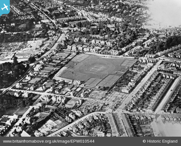
EPW010544 ENGLAND (1924). Sports Ground off Cassio Road, Watford, 1924. This image has been produced from a copy-negative.
© Copyright OpenStreetMap contributors and licensed by the OpenStreetMap Foundation. 2025. Cartography is licensed as CC BY-SA.
Nearby Images (5)
Details
| Title | [EPW010544] Sports Ground off Cassio Road, Watford, 1924. This image has been produced from a copy-negative. |
| Reference | EPW010544 |
| Date | 28-May-1924 |
| Link | |
| Place name | WATFORD |
| Parish | |
| District | |
| Country | ENGLAND |
| Easting / Northing | 510468, 196490 |
| Longitude / Latitude | -0.40288036964182, 51.655863295143 |
| National Grid Reference | TQ105965 |
Pins
 H.E. |
Sunday 11th of February 2024 06:22:42 PM | |
 H.E. |
Sunday 11th of February 2024 06:20:26 PM | |
 H.E. |
Sunday 11th of February 2024 06:16:12 PM | |
 H.E. |
Sunday 11th of February 2024 06:15:32 PM | |
 H.E. |
Sunday 11th of February 2024 06:13:53 PM | |
 H.E. |
Sunday 11th of February 2024 06:13:09 PM | |
 H.E. |
Sunday 11th of February 2024 06:09:26 PM | |
 H.E. |
Sunday 11th of February 2024 06:08:39 PM | |
 H.E. |
Sunday 11th of February 2024 06:07:38 PM | |
 H.E. |
Sunday 11th of February 2024 06:05:50 PM |


![[EPW010544] Sports Ground off Cassio Road, Watford, 1924. This image has been produced from a copy-negative.](http://britainfromabove.org.uk/sites/all/libraries/aerofilms-images/public/100x100/EPW/010/EPW010544.jpg)
![[EAW026499] West Herts Sports Ground and the town, Watford, from the south-west, 1949](http://britainfromabove.org.uk/sites/all/libraries/aerofilms-images/public/100x100/EAW/026/EAW026499.jpg)
![[EPW040466] West Herts Sports Club and environs, Watford, 1932](http://britainfromabove.org.uk/sites/all/libraries/aerofilms-images/public/100x100/EPW/040/EPW040466.jpg)
![[EPW051268] Watford Peace Memorial Hospital, Watford, 1936](http://britainfromabove.org.uk/sites/all/libraries/aerofilms-images/public/100x100/EPW/051/EPW051268.jpg)
![[EAW026500] The town, Watford, from the south-west, 1949](http://britainfromabove.org.uk/sites/all/libraries/aerofilms-images/public/100x100/EAW/026/EAW026500.jpg)