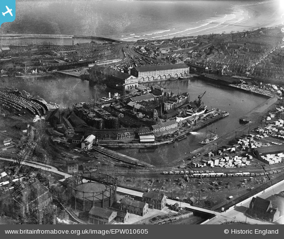
EPW010605 ENGLAND (1924). Gray's Dockyard and environs, Hartlepool, 1924
© Copyright OpenStreetMap contributors and licensed by the OpenStreetMap Foundation. 2025. Cartography is licensed as CC BY-SA.
Nearby Images (6)
Details
| Title | [EPW010605] Gray's Dockyard and environs, Hartlepool, 1924 |
| Reference | EPW010605 |
| Date | 14-June-1924 |
| Link | |
| Place name | HARTLEPOOL |
| Parish | |
| District | |
| Country | ENGLAND |
| Easting / Northing | 451173, 533092 |
| Longitude / Latitude | -1.2060491581356, 54.690158133914 |
| National Grid Reference | NZ512331 |
Pins
Be the first to add a comment to this image!


![[EPW010605] Gray's Dockyard and environs, Hartlepool, 1924](http://britainfromabove.org.uk/sites/all/libraries/aerofilms-images/public/100x100/EPW/010/EPW010605.jpg)
![[EAW695745] HMS Trincomalee and PSS Wingfield Castle, Jackson Dock, Hartlepool, 2003](http://britainfromabove.org.uk/sites/all/libraries/aerofilms-images/public/100x100/EAW/695/EAW695745.jpg)
![[EPW010606] Gray's Dockyard and environs, Hartlepool, 1924](http://britainfromabove.org.uk/sites/all/libraries/aerofilms-images/public/100x100/EPW/010/EPW010606.jpg)
![[EPW010607] Gray's Dockyard, Hartlepool, 1924](http://britainfromabove.org.uk/sites/all/libraries/aerofilms-images/public/100x100/EPW/010/EPW010607.jpg)
![[EPW010604] Gray's Dockyard, Hartlepool, 1924](http://britainfromabove.org.uk/sites/all/libraries/aerofilms-images/public/100x100/EPW/010/EPW010604.jpg)
![[EAW009424] The docks, Hartlepool, 1947. This image has been produced from a print.](http://britainfromabove.org.uk/sites/all/libraries/aerofilms-images/public/100x100/EAW/009/EAW009424.jpg)