
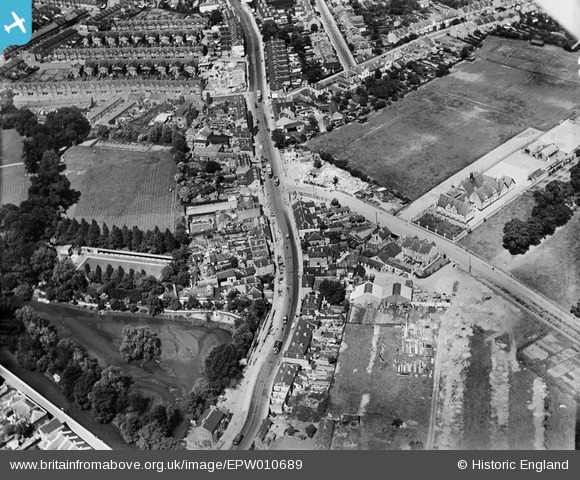
EPW010689 ENGLAND (1924). The High Street, Colliers Wood, 1924
© Copyright OpenStreetMap contributors and licensed by the OpenStreetMap Foundation. 2025. Cartography is licensed as CC BY-SA.
Nearby Images (8)
EPW010689

EPW027549

EPW027546

EPW027548

EPW027544

EPW027545

EPW027541

EPW037832

Details
| Title | [EPW010689] The High Street, Colliers Wood, 1924 |
| Reference | EPW010689 |
| Date | 21-June-1924 |
| Link | |
| Place name | COLLIERS WOOD |
| Parish | |
| District | |
| Country | ENGLAND |
| Easting / Northing | 526753, 170324 |
| Longitude / Latitude | -0.17697915994656, 51.417249813799 |
| National Grid Reference | TQ268703 |
Pins
 Arthur |
Thursday 9th of June 2016 10:48:42 AM | |
Arthur |
Thursday 9th of June 2016 10:46:47 AM | |
Wade |
Tuesday 11th of November 2014 04:18:46 PM | |
Wade |
Monday 8th of September 2014 09:24:50 AM |