
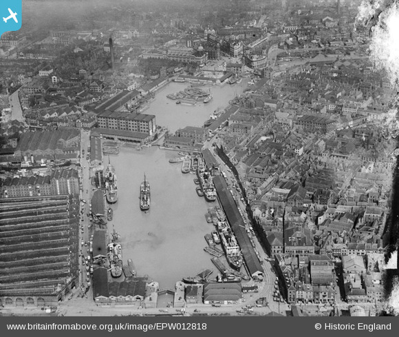
EPW012818 ENGLAND (1925). Prince's Dock and Humber Dock, Kingston upon Hull, 1925
© Copyright OpenStreetMap contributors and licensed by the OpenStreetMap Foundation. 2025. Cartography is licensed as CC BY-SA.
Nearby Images (8)
EPW012818

EAW046136

EAW028626

EPW012697

EPW012696

EAW046134

EAW028627

EPW010789

Details
| Title | [EPW012818] Prince's Dock and Humber Dock, Kingston upon Hull, 1925 |
| Reference | EPW012818 |
| Date | May-1925 |
| Link | |
| Place name | KINGSTON UPON HULL |
| Parish | |
| District | |
| Country | ENGLAND |
| Easting / Northing | 509728, 428417 |
| Longitude / Latitude | -0.33613433677543, 53.740350459183 |
| National Grid Reference | TA097284 |
Pins
 John Wass |
Tuesday 16th of May 2017 12:18:44 PM | |
 |
John Wass |
Tuesday 16th of May 2017 12:12:00 PM |
John Wass |
Tuesday 16th of May 2017 12:02:51 PM |