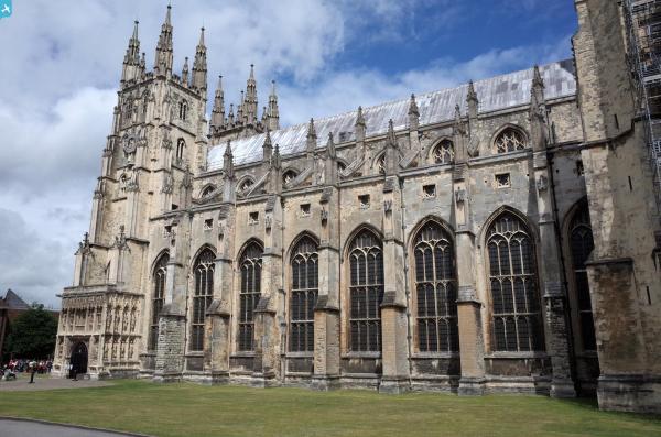
EPW013271 ENGLAND (1925). Christ Church Cathedral and the town centre, Canterbury, 1925

© Copyright OpenStreetMap contributors and licensed by the OpenStreetMap Foundation. 2025. Cartography is licensed as CC BY-SA.
Nearby Images (26)
EPW013271

EPW009144

EAW047757

EAW047755

EPW009140

EAW004807

EAW047756

EAW011399

EAW004808

EAW004809

EPW000393

EAW004806

EPW038149

EPW009143

EPW009139

EPW009147

EPW013272

EPW009146

EPW009141

EAW028822

EAW017600

EAW028821

EAW014335

EAW017599

EAW017598

EAW014334

Details
| Title | [EPW013271] Christ Church Cathedral and the town centre, Canterbury, 1925 |
| Reference | EPW013271 |
| Date | June-1925 |
| Link | |
| Place name | CANTERBURY |
| Parish | |
| District | |
| Country | ENGLAND |
| Easting / Northing | 615065, 157937 |
| Longitude / Latitude | 1.0841065446257, 51.279405308566 |
| National Grid Reference | TR151579 |
Pins
 senusret |
Monday 7th of March 2016 12:11:16 AM | |
Bryn |
Tuesday 16th of February 2016 04:41:29 PM | |
 Alan McFaden |
Thursday 10th of July 2014 01:04:48 PM | |
Alan McFaden |
Thursday 10th of July 2014 01:04:01 PM | |
Alan McFaden |
Thursday 10th of July 2014 01:02:20 PM |
.jpg?itok=A7UJk36N)