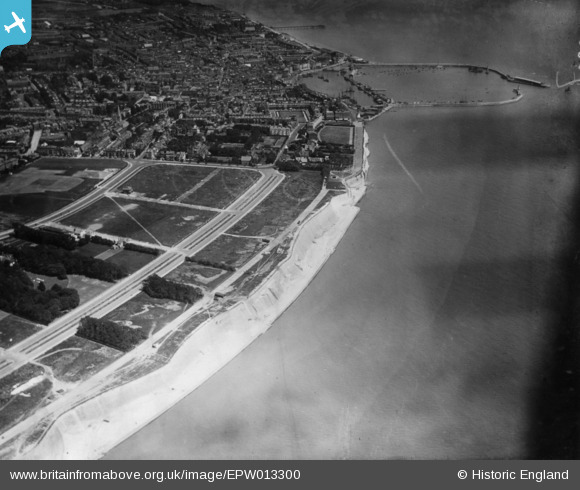
EPW013300 ENGLAND (1925). Royal Esplanade looking towards Royal Harbour and the town, Ramsgate, 1925. This image has been produced from a print.
© Copyright OpenStreetMap contributors and licensed by the OpenStreetMap Foundation. 2025. Cartography is licensed as CC BY-SA.
Nearby Images (6)
Details
| Title | [EPW013300] Royal Esplanade looking towards Royal Harbour and the town, Ramsgate, 1925. This image has been produced from a print. |
| Reference | EPW013300 |
| Date | June-1925 |
| Link | |
| Place name | RAMSGATE |
| Parish | RAMSGATE |
| District | |
| Country | ENGLAND |
| Easting / Northing | 637404, 164177 |
| Longitude / Latitude | 1.4080276564909, 51.326552352176 |
| National Grid Reference | TR374642 |
Pins
Be the first to add a comment to this image!


![[EPW013300] Royal Esplanade looking towards Royal Harbour and the town, Ramsgate, 1925. This image has been produced from a print.](http://britainfromabove.org.uk/sites/all/libraries/aerofilms-images/public/100x100/EPW/013/EPW013300.jpg)
![[EPW052887] The town and seafront, Ramsgate, from the south-west, 1937. This image has been produced from a print.](http://britainfromabove.org.uk/sites/all/libraries/aerofilms-images/public/100x100/EPW/052/EPW052887.jpg)
![[EAW009020] West Cliff and the residential area surrounding London Road, Ramsgate, 1947](http://britainfromabove.org.uk/sites/all/libraries/aerofilms-images/public/100x100/EAW/009/EAW009020.jpg)
![[EAW009021] West Cliff, Grange Road and the surrounding area, Ramsgate, 1947](http://britainfromabove.org.uk/sites/all/libraries/aerofilms-images/public/100x100/EAW/009/EAW009021.jpg)
![[EAW009025] The Royal Esplanade, West Cliff and the seafront, Ramsgate, 1947](http://britainfromabove.org.uk/sites/all/libraries/aerofilms-images/public/100x100/EAW/009/EAW009025.jpg)
![[EPW013299] Grange Road and environs, Ramsgate, 1925. This image has been produced from a copy-negative.](http://britainfromabove.org.uk/sites/all/libraries/aerofilms-images/public/100x100/EPW/013/EPW013299.jpg)