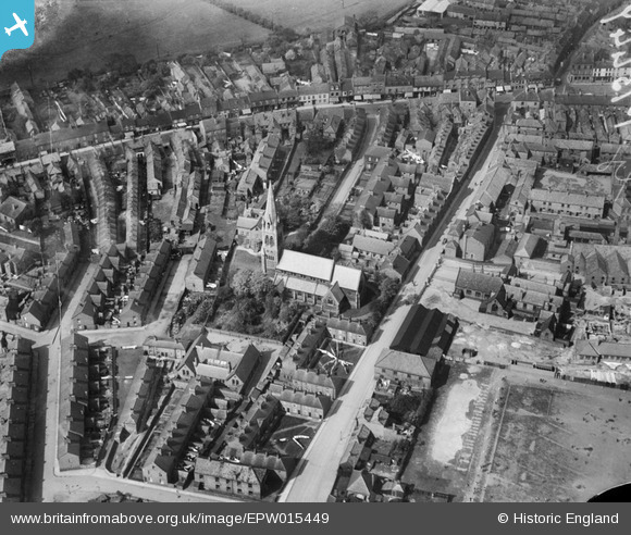
EPW015449 ENGLAND (1926). St James's Church, Selby, 1926
© Copyright OpenStreetMap contributors and licensed by the OpenStreetMap Foundation. 2025. Cartography is licensed as CC BY-SA.
Details
| Title | [EPW015449] St James's Church, Selby, 1926 |
| Reference | EPW015449 |
| Date | 4-May-1926 |
| Link | |
| Place name | SELBY |
| Parish | SELBY |
| District | |
| Country | ENGLAND |
| Easting / Northing | 461294, 432210 |
| Longitude / Latitude | -1.06966378183, 53.782386663761 |
| National Grid Reference | SE613322 |
Pins
 nick |
Thursday 25th of March 2021 06:48:44 PM | |
 noonday |
Tuesday 12th of March 2019 08:59:48 PM | |
 Duncan |
Monday 2nd of January 2017 01:43:56 AM | |
 MB |
Tuesday 2nd of April 2013 10:41:41 AM | |
 chaz |
Monday 11th of March 2013 10:33:22 PM | |
 chaz |
Saturday 23rd of February 2013 08:13:36 PM | |
 chaz |
Saturday 23rd of February 2013 08:07:01 PM | |
 Class31 |
Friday 26th of October 2012 10:47:50 AM | |
 Class31 |
Friday 26th of October 2012 10:32:24 AM | |
 Class31 |
Friday 26th of October 2012 10:31:50 AM | |
 Class31 |
Friday 26th of October 2012 10:30:32 AM | |
 Class31 |
Friday 26th of October 2012 10:30:13 AM | |
 Class31 |
Friday 26th of October 2012 10:29:35 AM | |
 Class31 |
Friday 26th of October 2012 10:28:57 AM | |
 Class31 |
Friday 26th of October 2012 10:28:37 AM | |
 Class31 |
Friday 26th of October 2012 10:28:01 AM |
User Comment Contributions
On 10th May 1944 a bomber hit the spire, 7 crew and 8 civilians were killed, the spire hasn't been rebuilt. |
 chaz |
Friday 22nd of February 2013 03:12:48 PM |


![[EPW015449] St James's Church, Selby, 1926](http://britainfromabove.org.uk/sites/all/libraries/aerofilms-images/public/100x100/EPW/015/EPW015449.jpg)
![[EAW015735] The town and River Ouse, Selby, from the west, 1948](http://britainfromabove.org.uk/sites/all/libraries/aerofilms-images/public/100x100/EAW/015/EAW015735.jpg)
![[EPW040263] Selby Abbey and the town centre, Selby, 1932](http://britainfromabove.org.uk/sites/all/libraries/aerofilms-images/public/100x100/EPW/040/EPW040263.jpg)
![[EPW015451] Selby Abbey, Selby, 1926](http://britainfromabove.org.uk/sites/all/libraries/aerofilms-images/public/100x100/EPW/015/EPW015451.jpg)