
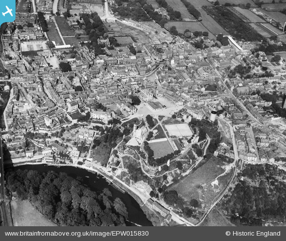
EPW015830 ENGLAND (1926). Knaresborough Castle and the town centre, Knaresborough, 1926
© Copyright OpenStreetMap contributors and licensed by the OpenStreetMap Foundation. 2025. Cartography is licensed as CC BY-SA.
Nearby Images (8)
EPW015830

EPW015827

EPW015791

EPW015828

EAW025646

EAW025643

EPW015829

EPW015831

Details
| Title | [EPW015830] Knaresborough Castle and the town centre, Knaresborough, 1926 |
| Reference | EPW015830 |
| Date | 5-June-1926 |
| Link | |
| Place name | KNARESBOROUGH |
| Parish | KNARESBOROUGH |
| District | |
| Country | ENGLAND |
| Easting / Northing | 434938, 456949 |
| Longitude / Latitude | -1.4668529017325, 54.007188987626 |
| National Grid Reference | SE349569 |
Pins
 John W |
Saturday 2nd of July 2016 05:35:51 PM | |
John W |
Saturday 2nd of July 2016 05:35:02 PM | |
Johnluty |
Sunday 19th of May 2013 01:38:15 PM | |
 Class31 |
Monday 16th of July 2012 04:33:38 PM | |
Class31 |
Monday 16th of July 2012 04:23:36 PM | |
Class31 |
Monday 16th of July 2012 04:23:15 PM |