
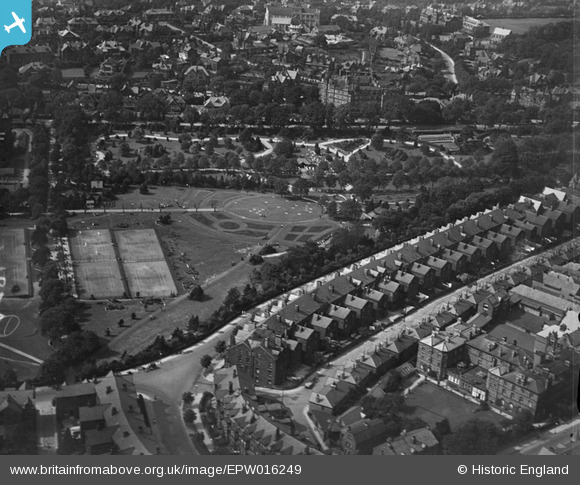
EPW016249 ENGLAND (1926). Valley Gardens, Harrogate, 1926
© Copyright OpenStreetMap contributors and licensed by the OpenStreetMap Foundation. 2025. Cartography is licensed as CC BY-SA.
Nearby Images (14)
EPW016249

EPW023533

EPW043170

EPW016245

EAW025656

EPW043177

EPW043179

EPW043180

EPW043178

EPW015800

EPW043173

EPW006589

EPW006598

EPW043171

Details
| Title | [EPW016249] Valley Gardens, Harrogate, 1926 |
| Reference | EPW016249 |
| Date | 14-July-1926 |
| Link | |
| Place name | HARROGATE |
| Parish | |
| District | |
| Country | ENGLAND |
| Easting / Northing | 429551, 455088 |
| Longitude / Latitude | -1.5492351578554, 53.990797964316 |
| National Grid Reference | SE296551 |
Pins
Be the first to add a comment to this image!