
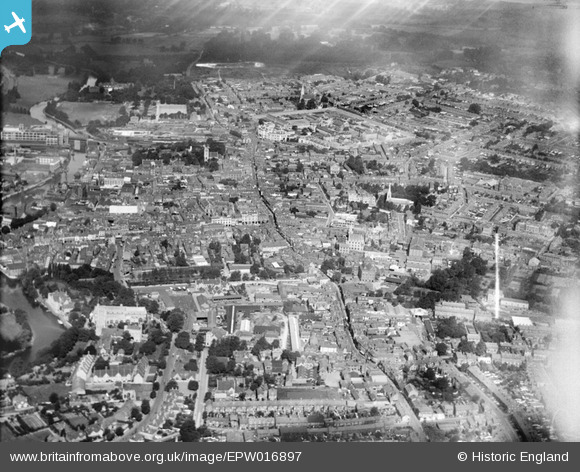
EPW016897 ENGLAND (1926). The town centre, Maidstone, from the south, 1926
© Copyright OpenStreetMap contributors and licensed by the OpenStreetMap Foundation. 2025. Cartography is licensed as CC BY-SA.
Nearby Images (5)
EPW016897

EPW001456

EPW005629

EPW026065

EPW005630

Details
| Title | [EPW016897] The town centre, Maidstone, from the south, 1926 |
| Reference | EPW016897 |
| Date | August-1926 |
| Link | |
| Place name | MAIDSTONE |
| Parish | |
| District | |
| Country | ENGLAND |
| Easting / Northing | 576169, 155562 |
| Longitude / Latitude | 0.52579946287389, 51.271427142345 |
| National Grid Reference | TQ762556 |
Pins
 lipsee |
Friday 25th of September 2015 09:49:53 AM | |
academy100 |
Saturday 8th of March 2014 08:54:17 AM | |
Steve |
Wednesday 28th of November 2012 09:22:37 PM | |
Steve |
Wednesday 28th of November 2012 09:20:48 PM |