
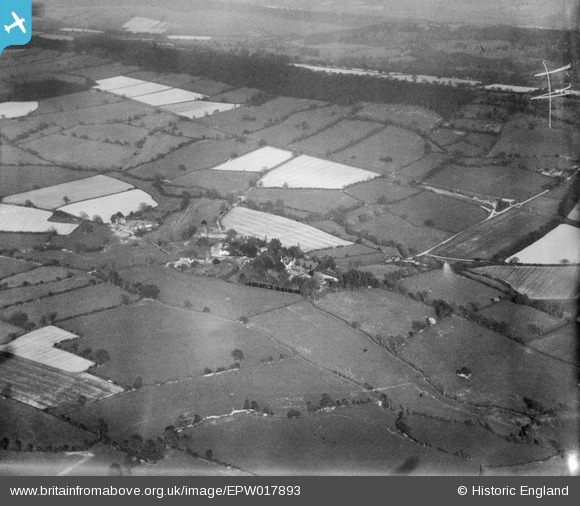
EPW017893 ENGLAND (1927). Countryside around the village, Rushbury, from the north-west, 1927
© Copyright OpenStreetMap contributors and licensed by the OpenStreetMap Foundation. 2025. Cartography is licensed as CC BY-SA.
Nearby Images (3)
EPW017893

EPW017905

EPW017906

Details
| Title | [EPW017893] Countryside around the village, Rushbury, from the north-west, 1927 |
| Reference | EPW017893 |
| Date | 11-May-1927 |
| Link | |
| Place name | RUSHBURY |
| Parish | RUSHBURY |
| District | |
| Country | ENGLAND |
| Easting / Northing | 350967, 291823 |
| Longitude / Latitude | -2.7227461443337, 52.521712190988 |
| National Grid Reference | SO510918 |
Pins
 Class31 |
Thursday 5th of July 2012 11:10:48 AM | |
Class31 |
Thursday 5th of July 2012 11:10:04 AM | |
Class31 |
Thursday 5th of July 2012 11:09:50 AM | |
Class31 |
Thursday 5th of July 2012 11:09:31 AM | |
Class31 |
Thursday 5th of July 2012 11:08:57 AM |
User Comment Contributions
See also EPW017891 to EPW017905 (excluding EPW017903) |
 BigglesH |
Monday 23rd of July 2012 07:24:23 PM |
Looking East over Ape Dale towards Wenlock Edge with Rushbury in the foreground. St. Peter's Parish Church may be seen together with a motte and Manor Farm. Rushbury Railway Station on the Craven Arms - Much Wenlock line of the Great Western Railway is in view. |
Class31 |
Thursday 5th of July 2012 11:13:57 AM |