
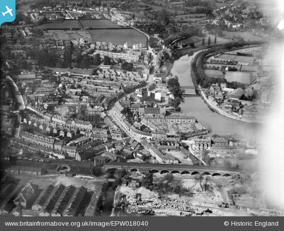
EPW018040 ENGLAND (1927). Greyfriars Bridge and environs, Shrewsbury, 1927
© Copyright OpenStreetMap contributors and licensed by the OpenStreetMap Foundation. 2025. Cartography is licensed as CC BY-SA.
Nearby Images (4)
EPW018040

EPW018049

EPW018043

EPW018053

Details
| Title | [EPW018040] Greyfriars Bridge and environs, Shrewsbury, 1927 |
| Reference | EPW018040 |
| Date | May-1927 |
| Link | |
| Place name | SHREWSBURY |
| Parish | SHREWSBURY |
| District | |
| Country | ENGLAND |
| Easting / Northing | 349649, 312167 |
| Longitude / Latitude | -2.7452707779468, 52.704485491675 |
| National Grid Reference | SJ496122 |
Pins
 Rick |
Saturday 3rd of January 2015 10:49:01 PM | |
Norrie P |
Friday 27th of June 2014 06:26:53 PM | |
MB |
Saturday 6th of October 2012 10:28:45 AM | |
MB |
Saturday 6th of October 2012 10:27:03 AM | |
MB |
Saturday 6th of October 2012 10:26:20 AM | |
MB |
Saturday 6th of October 2012 10:23:57 AM | |
MB |
Saturday 6th of October 2012 10:23:07 AM | |
MB |
Saturday 6th of October 2012 10:20:54 AM | |
MB |
Saturday 6th of October 2012 10:20:26 AM | |
MB |
Saturday 6th of October 2012 10:19:49 AM | |
MB |
Saturday 6th of October 2012 10:18:14 AM | |
 Class31 |
Monday 1st of October 2012 09:18:29 PM |