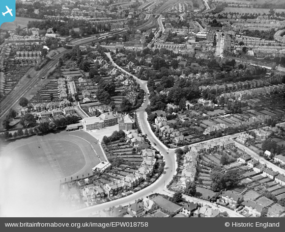
EPW018758 ENGLAND (1927). Gayton Road and environs, Harrow, 1927
© Copyright OpenStreetMap contributors and licensed by the OpenStreetMap Foundation. 2024. Cartography is licensed as CC BY-SA.
Details
| Title | [EPW018758] Gayton Road and environs, Harrow, 1927 |
| Reference | EPW018758 |
| Date | July-1927 |
| Link | |
| Place name | HARROW |
| Parish | |
| District | |
| Country | ENGLAND |
| Easting / Northing | 515916, 188140 |
| Longitude / Latitude | -0.32691274110639, 51.579712185518 |
| National Grid Reference | TQ159881 |
Pins
 The Laird |
Saturday 18th of February 2023 08:51:13 PM | |
 The Laird |
Saturday 18th of February 2023 08:48:28 PM | |
 The Laird |
Saturday 18th of February 2023 08:41:22 PM | |
 The Laird |
Saturday 18th of February 2023 08:40:06 PM | |
 The Laird |
Saturday 18th of February 2023 08:28:47 PM | |
 The Laird |
Saturday 17th of November 2018 06:08:02 PM | |
 The Laird |
Saturday 17th of November 2018 06:06:14 PM | |
 The Laird |
Saturday 17th of November 2018 06:05:06 PM | |
 The Laird |
Saturday 17th of November 2018 05:56:10 PM | |
 The Laird |
Saturday 17th of November 2018 05:49:51 PM | |
 The Laird |
Saturday 17th of November 2018 05:39:06 PM | |
 The Laird |
Saturday 17th of November 2018 05:28:42 PM | |
 Coventry kid |
Tuesday 2nd of August 2016 03:55:22 PM | |
 Coventry kid |
Tuesday 2nd of August 2016 03:53:04 PM | |
 Coventry kid |
Tuesday 2nd of August 2016 03:52:17 PM | |
 Coventry kid |
Tuesday 2nd of August 2016 03:51:27 PM | |
 Sweet Pete |
Monday 16th of March 2015 03:48:27 PM | |
 Sweet Pete |
Thursday 26th of February 2015 03:34:04 PM | |
 Sweet Pete |
Thursday 26th of February 2015 03:33:39 PM | |
 DLJ |
Wednesday 27th of June 2012 12:06:47 AM | |
 DLJ |
Wednesday 27th of June 2012 12:05:28 AM |


![[EPW018758] Gayton Road and environs, Harrow, 1927](http://britainfromabove.org.uk/sites/all/libraries/aerofilms-images/public/100x100/EPW/018/EPW018758.jpg)
![[EPW025537] De Havilland DH60 Moth G-EBZT in flight over Greenhill, Harrow, 1928. This image has been produced from a damaged negative.](http://britainfromabove.org.uk/sites/all/libraries/aerofilms-images/public/100x100/EPW/025/EPW025537.jpg)
![[EPW018761] The playing field of Harrow County School for Boys, Harrow, 1927](http://britainfromabove.org.uk/sites/all/libraries/aerofilms-images/public/100x100/EPW/018/EPW018761.jpg)