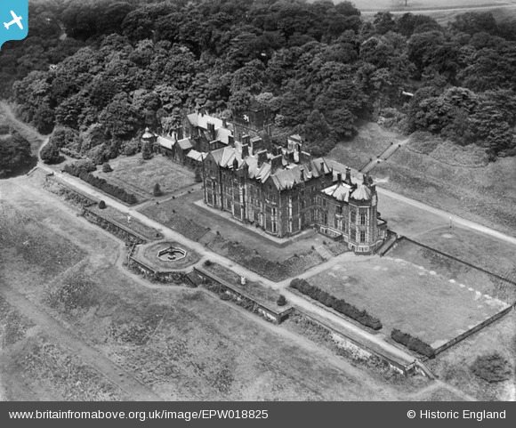
EPW018825 ENGLAND (1927). Worlsey Hall, Worsley, 1927
© Copyright OpenStreetMap contributors and licensed by the OpenStreetMap Foundation. 2024. Cartography is licensed as CC BY-SA.
Details
| Title | [EPW018825] Worlsey Hall, Worsley, 1927 |
| Reference | EPW018825 |
| Date | 10-July-1927 |
| Link | |
| Place name | WORSLEY |
| Parish | |
| District | |
| Country | ENGLAND |
| Easting / Northing | 374148, 400702 |
| Longitude / Latitude | -2.3897914393126, 53.502127097642 |
| National Grid Reference | SD741007 |
Pins
Be the first to add a comment to this image!


![[EPW018825] Worlsey Hall, Worsley, 1927](http://britainfromabove.org.uk/sites/all/libraries/aerofilms-images/public/100x100/EPW/018/EPW018825.jpg)
![[EPW018824] Worlsey Hall, Worsley, 1927](http://britainfromabove.org.uk/sites/all/libraries/aerofilms-images/public/100x100/EPW/018/EPW018824.jpg)
