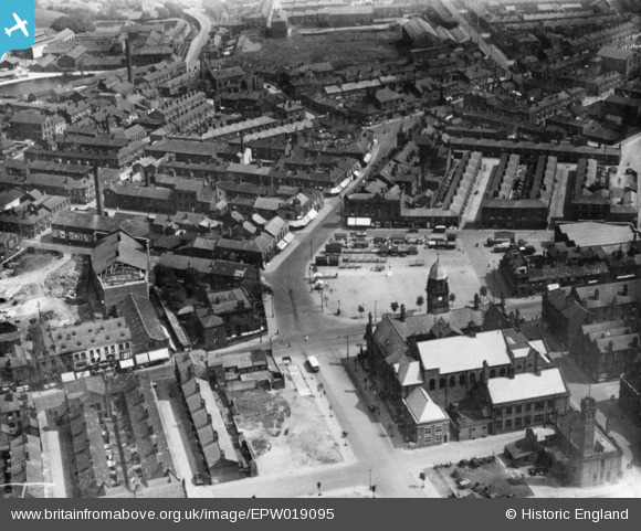
EPW019095 ENGLAND (1927). The Market Place and environs, Hyde, 1927. This image has been produced from a copy-negative.
© Copyright OpenStreetMap contributors and licensed by the OpenStreetMap Foundation. 2025. Cartography is licensed as CC BY-SA.
Details
| Title | [EPW019095] The Market Place and environs, Hyde, 1927. This image has been produced from a copy-negative. |
| Reference | EPW019095 |
| Date | 4-August-1927 |
| Link | |
| Place name | HYDE |
| Parish | |
| District | |
| Country | ENGLAND |
| Easting / Northing | 394856, 394971 |
| Longitude / Latitude | -2.0774672902841, 53.451218659178 |
| National Grid Reference | SJ949950 |
Pins
 manutdmrs |
Thursday 21st of April 2022 11:56:06 PM | |
 manutdmrs |
Thursday 21st of April 2022 11:55:07 PM | |
 vince20 |
Saturday 17th of February 2018 01:27:27 AM | |
 Les H |
Thursday 19th of May 2016 11:45:28 AM | |
 Les H |
Thursday 19th of May 2016 11:44:05 AM | |
 Les H |
Thursday 19th of May 2016 11:42:04 AM | |
 Les H |
Thursday 19th of May 2016 11:40:07 AM | |
 Les H |
Thursday 19th of May 2016 11:39:04 AM | |
 Les H |
Thursday 19th of May 2016 11:38:16 AM | |
 Les H |
Thursday 19th of May 2016 11:36:53 AM | |
 TheBlueCube |
Sunday 16th of November 2014 06:33:15 PM |


![[EPW019095] The Market Place and environs, Hyde, 1927. This image has been produced from a copy-negative.](http://britainfromabove.org.uk/sites/all/libraries/aerofilms-images/public/100x100/EPW/019/EPW019095.jpg)
![[EPW019098] The Market Place and environs, Hyde, 1927. This image has been produced from a copy-negative.](http://britainfromabove.org.uk/sites/all/libraries/aerofilms-images/public/100x100/EPW/019/EPW019098.jpg)
![[EPW019097] The town centre, Hyde, 1927. This image has been produced from a copy-negative.](http://britainfromabove.org.uk/sites/all/libraries/aerofilms-images/public/100x100/EPW/019/EPW019097.jpg)
![[EPW019096] Travis Street, Mottram Road and environs, Hyde, 1927. This image has been produced from a damaged print.](http://britainfromabove.org.uk/sites/all/libraries/aerofilms-images/public/100x100/EPW/019/EPW019096.jpg)