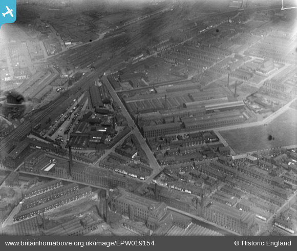
EPW019154 ENGLAND (1927). Robinson's Railway Works and environs, Rochdale, 1927
© Copyright OpenStreetMap contributors and licensed by the OpenStreetMap Foundation. 2025. Cartography is licensed as CC BY-SA.
Nearby Images (15)
Details
| Title | [EPW019154] Robinson's Railway Works and environs, Rochdale, 1927 |
| Reference | EPW019154 |
| Date | August-1927 |
| Link | |
| Place name | ROCHDALE |
| Parish | |
| District | |
| Country | ENGLAND |
| Easting / Northing | 390351, 412714 |
| Longitude / Latitude | -2.1458582450246, 53.610654085664 |
| National Grid Reference | SD904127 |
Pins
 HILLARY |
Saturday 16th of May 2015 03:30:53 PM |


![[EPW019154] Robinson's Railway Works and environs, Rochdale, 1927](http://britainfromabove.org.uk/sites/all/libraries/aerofilms-images/public/100x100/EPW/019/EPW019154.jpg)
![[EPW051221] Thomas Robinson and Son Railway Works and environs, Rochdale, 1936. This image has been produced from copy-negative.](http://britainfromabove.org.uk/sites/all/libraries/aerofilms-images/public/100x100/EPW/051/EPW051221.jpg)
![[EPW019424] Robinson's Railway Works and environs, Rochdale, 1927](http://britainfromabove.org.uk/sites/all/libraries/aerofilms-images/public/100x100/EPW/019/EPW019424.jpg)
![[EPW019151] Robinson's Railway Works and environs, Rochdale, 1927](http://britainfromabove.org.uk/sites/all/libraries/aerofilms-images/public/100x100/EPW/019/EPW019151.jpg)
![[EPW019150] Robinson's Railway Works and environs, Rochdale, 1927](http://britainfromabove.org.uk/sites/all/libraries/aerofilms-images/public/100x100/EPW/019/EPW019150.jpg)
![[EPW019153] Robinson's Railway Works, Rochdale, 1927](http://britainfromabove.org.uk/sites/all/libraries/aerofilms-images/public/100x100/EPW/019/EPW019153.jpg)
![[EPW019425] Robinson's Railway Works, Rochdale, 1927](http://britainfromabove.org.uk/sites/all/libraries/aerofilms-images/public/100x100/EPW/019/EPW019425.jpg)
![[EPW019426] Robinson's Railway Works, Rochdale, 1927](http://britainfromabove.org.uk/sites/all/libraries/aerofilms-images/public/100x100/EPW/019/EPW019426.jpg)
![[EPW019423] Robinson's Railway Works, Rochdale, 1927](http://britainfromabove.org.uk/sites/all/libraries/aerofilms-images/public/100x100/EPW/019/EPW019423.jpg)
![[EPW019427] Robinson's Railway Works, Rochdale, 1927](http://britainfromabove.org.uk/sites/all/libraries/aerofilms-images/public/100x100/EPW/019/EPW019427.jpg)
![[EPW016789] The railway works on Fishwick Street, Rochdale, 1926](http://britainfromabove.org.uk/sites/all/libraries/aerofilms-images/public/100x100/EPW/016/EPW016789.jpg)
![[EPW019155] Robinson's Railway Works, the recreation ground and environs, Rochdale, 1927](http://britainfromabove.org.uk/sites/all/libraries/aerofilms-images/public/100x100/EPW/019/EPW019155.jpg)
![[EPW019149] Robinson's Railway Works, Rochdale, 1927](http://britainfromabove.org.uk/sites/all/libraries/aerofilms-images/public/100x100/EPW/019/EPW019149.jpg)
![[EPW019152] Robinson's Railway Works and the Recreation Ground, Rochdale, 1927](http://britainfromabove.org.uk/sites/all/libraries/aerofilms-images/public/100x100/EPW/019/EPW019152.jpg)
![[EPW051224] Thomas Robinson and Son Railway Works and environs, Rochdale, 1936. This image has been produced from copy-negative.](http://britainfromabove.org.uk/sites/all/libraries/aerofilms-images/public/100x100/EPW/051/EPW051224.jpg)