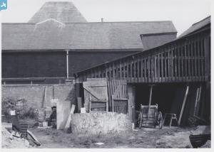
EPW019216 ENGLAND (1927). St Paul's Church and environs, Luton, 1927
© Copyright OpenStreetMap contributors and licensed by the OpenStreetMap Foundation. 2025. Cartography is licensed as CC BY-SA.
Nearby Images (11)
Details
| Title | [EPW019216] St Paul's Church and environs, Luton, 1927 |
| Reference | EPW019216 |
| Date | 29-August-1927 |
| Link | |
| Place name | LUTON |
| Parish | |
| District | |
| Country | ENGLAND |
| Easting / Northing | 509269, 220566 |
| Longitude / Latitude | -0.41263446022627, 51.872508770113 |
| National Grid Reference | TL093206 |
Pins
 rptomkins |
Saturday 16th of January 2021 06:07:40 PM | |
 kayhannah |
Thursday 9th of January 2020 09:49:46 PM | |
 kayhannah |
Thursday 9th of January 2020 09:38:22 PM | |
 kayhannah |
Thursday 9th of January 2020 09:37:27 PM | |
 kayhannah |
Thursday 9th of January 2020 09:36:09 PM | |
 KENLUTON |
Friday 12th of June 2015 10:18:19 PM | |
 KENLUTON |
Friday 12th of June 2015 10:15:04 PM | |
 KENLUTON |
Friday 12th of June 2015 10:14:17 PM | |
 Paul525 |
Sunday 26th of May 2013 06:14:42 PM |


![[EPW019216] St Paul's Church and environs, Luton, 1927](http://britainfromabove.org.uk/sites/all/libraries/aerofilms-images/public/100x100/EPW/019/EPW019216.jpg)
![[EAW032044] Williams and Howard Ltd Leonic (Paint) Works and environs, Luton, 1950. This image was marked by Aerofilms Ltd for photo editing.](http://britainfromabove.org.uk/sites/all/libraries/aerofilms-images/public/100x100/EAW/032/EAW032044.jpg)
![[EAW032047] Williams and Howard Ltd Leonic (Paint) Works and environs, Luton, 1950. This image was marked by Aerofilms Ltd for photo editing.](http://britainfromabove.org.uk/sites/all/libraries/aerofilms-images/public/100x100/EAW/032/EAW032047.jpg)
![[EAW032049] Williams and Howard Ltd Leonic (Paint) Works and environs, Luton, 1950. This image was marked by Aerofilms Ltd for photo editing.](http://britainfromabove.org.uk/sites/all/libraries/aerofilms-images/public/100x100/EAW/032/EAW032049.jpg)
![[EAW032048] Williams and Howard Ltd Leonic (Paint) Works and environs, Luton, 1950. This image was marked by Aerofilms Ltd for photo editing.](http://britainfromabove.org.uk/sites/all/libraries/aerofilms-images/public/100x100/EAW/032/EAW032048.jpg)
![[EAW032050] Williams and Howard Ltd Leonic (Paint) Works and environs, Luton, 1950. This image was marked by Aerofilms Ltd for photo editing.](http://britainfromabove.org.uk/sites/all/libraries/aerofilms-images/public/100x100/EAW/032/EAW032050.jpg)
![[EAW032042] Williams and Howard Ltd Leonic (Paint) Works, Luton, 1950. This image was marked by Aerofilms Ltd for photo editing.](http://britainfromabove.org.uk/sites/all/libraries/aerofilms-images/public/100x100/EAW/032/EAW032042.jpg)
![[EAW032046] Williams and Howard Ltd Leonic (Paint) Works and environs, Luton, 1950. This image was marked by Aerofilms Ltd for photo editing.](http://britainfromabove.org.uk/sites/all/libraries/aerofilms-images/public/100x100/EAW/032/EAW032046.jpg)
![[EAW032045] Williams and Howard Ltd Leonic (Paint) Works and environs, Luton, 1950. This image was marked by Aerofilms Ltd for photo editing.](http://britainfromabove.org.uk/sites/all/libraries/aerofilms-images/public/100x100/EAW/032/EAW032045.jpg)
![[EAW032041] Williams and Howard Ltd Leonic (Paint) Works and environs, Luton, 1950. This image was marked by Aerofilms Ltd for photo editing.](http://britainfromabove.org.uk/sites/all/libraries/aerofilms-images/public/100x100/EAW/032/EAW032041.jpg)
![[EAW032043] Williams and Howard Ltd Leonic (Paint) Works and environs, Luton, 1950. This image was marked by Aerofilms Ltd for photo editing.](http://britainfromabove.org.uk/sites/all/libraries/aerofilms-images/public/100x100/EAW/032/EAW032043.jpg)
