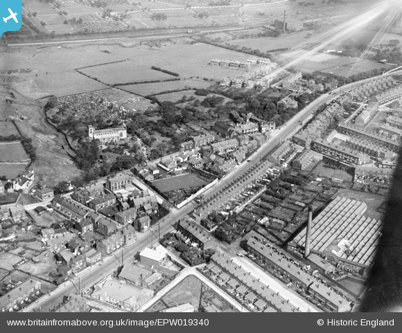
EPW019340 ENGLAND (1927). Wigan Road, Deane, 1927
© Copyright OpenStreetMap contributors and licensed by the OpenStreetMap Foundation. 2025. Cartography is licensed as CC BY-SA.
Details
| Title | [EPW019340] Wigan Road, Deane, 1927 |
| Reference | EPW019340 |
| Date | 27-September-1927 |
| Link | |
| Place name | DEANE |
| Parish | |
| District | |
| Country | ENGLAND |
| Easting / Northing | 369392, 408042 |
| Longitude / Latitude | -2.4622171269125, 53.567851893724 |
| National Grid Reference | SD694080 |
Pins
 dave44 |
Friday 1st of April 2016 04:45:25 PM | |
 dave44 |
Friday 1st of April 2016 04:44:24 PM | |
 dave44 |
Friday 1st of April 2016 04:42:50 PM | |
 Keith Bowden |
Friday 17th of April 2015 12:08:39 PM | |
 Tony Watts |
Sunday 26th of May 2013 06:59:32 PM | |
 SMJ |
Thursday 27th of December 2012 01:19:53 PM | |
 SMJ |
Thursday 27th of December 2012 01:19:25 PM |
User Comment Contributions
 Keith Bowden |
Friday 17th of April 2015 12:12:13 PM |


![[EPW019340] Wigan Road, Deane, 1927](http://britainfromabove.org.uk/sites/all/libraries/aerofilms-images/public/100x100/EPW/019/EPW019340.jpg)
![[EPW018661] Wigan Road and environs, Deane, 1927](http://britainfromabove.org.uk/sites/all/libraries/aerofilms-images/public/100x100/EPW/018/EPW018661.jpg)
![[EPW019339] St Mary's Church and environs, Deane, 1927](http://britainfromabove.org.uk/sites/all/libraries/aerofilms-images/public/100x100/EPW/019/EPW019339.jpg)
![[EPW018662] Wigan Road and environs, Deane, 1927](http://britainfromabove.org.uk/sites/all/libraries/aerofilms-images/public/100x100/EPW/018/EPW018662.jpg)
