
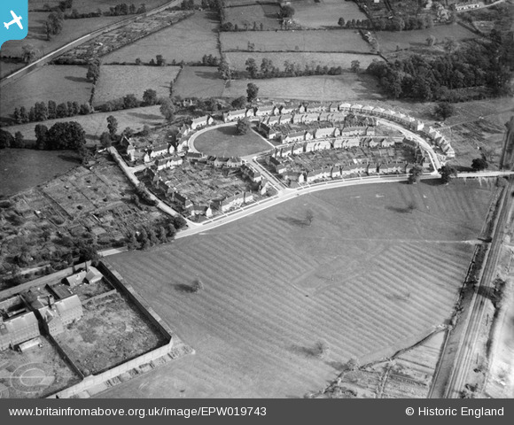
EPW019743 ENGLAND (1927). Cape Road, The Cape, 1927
© Copyright OpenStreetMap contributors and licensed by the OpenStreetMap Foundation. 2025. Cartography is licensed as CC BY-SA.
Nearby Images (2)
EPW019743

EPW000420

Details
| Title | [EPW019743] Cape Road, The Cape, 1927 |
| Reference | EPW019743 |
| Date | October-1927 |
| Link | |
| Place name | THE CAPE |
| Parish | WARWICK |
| District | |
| Country | ENGLAND |
| Easting / Northing | 427859, 265699 |
| Longitude / Latitude | -1.5915217180988, 52.288328431032 |
| National Grid Reference | SP279657 |
Pins
 Nicholas Ball |
Monday 24th of September 2012 03:54:24 PM | |
Typo on "Cape". |
Nicholas Ball |
Sunday 3rd of February 2013 10:34:28 AM |
Robot Archie |
Sunday 26th of August 2012 09:14:17 PM | |
Robot Archie |
Sunday 26th of August 2012 09:13:39 PM | |
Robot Archie |
Sunday 26th of August 2012 09:12:53 PM | |
Robot Archie |
Sunday 26th of August 2012 09:11:55 PM | |
Robot Archie |
Sunday 26th of August 2012 09:10:54 PM | |
Robot Archie |
Sunday 26th of August 2012 09:10:18 PM | |
Robot Archie |
Sunday 26th of August 2012 09:09:48 PM | |
Robot Archie |
Sunday 26th of August 2012 09:09:25 PM | |
Robot Archie |
Sunday 26th of August 2012 09:08:45 PM | |
Robot Archie |
Sunday 26th of August 2012 09:07:33 PM |