
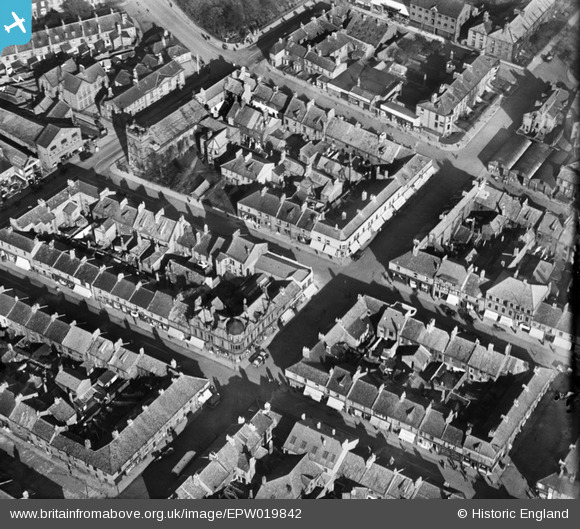
EPW019842 ENGLAND (1927). West Percy Street and environs, North Shields, 1927
© Copyright OpenStreetMap contributors and licensed by the OpenStreetMap Foundation. 2025. Cartography is licensed as CC BY-SA.
Nearby Images (3)
EPW019842

EPW019843

EPW019841

Details
| Title | [EPW019842] West Percy Street and environs, North Shields, 1927 |
| Reference | EPW019842 |
| Date | October-1927 |
| Link | |
| Place name | NORTH SHIELDS |
| Parish | |
| District | |
| Country | ENGLAND |
| Easting / Northing | 435363, 568504 |
| Longitude / Latitude | -1.4469905976264, 55.009765250362 |
| National Grid Reference | NZ354685 |
Pins
 Blifster |
Thursday 15th of April 2021 04:51:37 PM | |
Blifster |
Thursday 15th of April 2021 04:47:27 PM | |
Adam |
Thursday 25th of February 2021 04:14:11 PM | |
Adam |
Thursday 25th of February 2021 04:13:35 PM | |
Adam |
Thursday 25th of February 2021 04:13:35 PM | |
Adam |
Thursday 25th of February 2021 04:12:47 PM |