
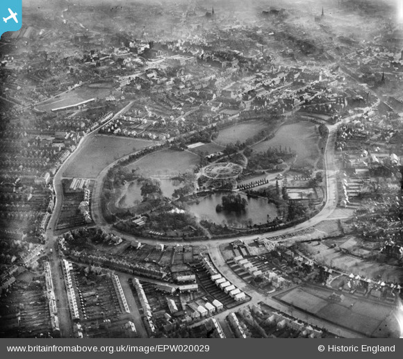
EPW020029 ENGLAND (1927). West Park and environs, Wolverhampton, 1927
© Copyright OpenStreetMap contributors and licensed by the OpenStreetMap Foundation. 2025. Cartography is licensed as CC BY-SA.
Nearby Images (3)
EPW020029

EPW024614

EPW024615

Details
| Title | [EPW020029] West Park and environs, Wolverhampton, 1927 |
| Reference | EPW020029 |
| Date | October-1927 |
| Link | |
| Place name | WOLVERHAMPTON |
| Parish | |
| District | |
| Country | ENGLAND |
| Easting / Northing | 390630, 299139 |
| Longitude / Latitude | -2.13832621496, 52.58961540321 |
| National Grid Reference | SO906991 |
Pins
 Dainase |
Sunday 5th of August 2012 09:45:52 PM | |
Where I was married, 1967. |
Janet S |
Wednesday 28th of January 2015 05:48:24 PM |
johnabutt |
Monday 30th of July 2012 08:18:48 PM | |
johnabutt |
Monday 30th of July 2012 08:18:03 PM | |
johnabutt |
Monday 30th of July 2012 08:17:27 PM | |
Correction, it's Molineux Street - minor typo I would guess |
Dainase |
Sunday 5th of August 2012 09:33:47 PM |
johnabutt |
Monday 30th of July 2012 08:16:12 PM | |
johnabutt |
Monday 30th of July 2012 08:15:40 PM | |
kevin_s |
Saturday 7th of July 2012 08:35:31 PM |

User Comment Contributions
Lived in Park Avenue, between West Park and Newhampton Road, between 1959 and 1967, 'spitting distance' from Wolves' ground. Could hear the crowd very clearly from our garden. |
Janet S |
Wednesday 28th of January 2015 05:51:13 PM |
 Wolverhampton Wanderers FC, Molineux 1927. |
kevin_s |
Saturday 7th of July 2012 08:41:29 PM |