
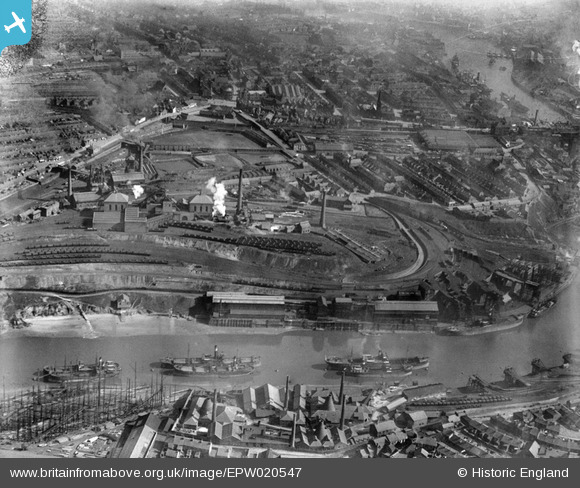
EPW020547 ENGLAND (1928). The Wearmouth Colliery, Sunderland, 1928
© Copyright OpenStreetMap contributors and licensed by the OpenStreetMap Foundation. 2025. Cartography is licensed as CC BY-SA.
Nearby Images (8)
EPW020547

EPW020551

EPW020552

EPW020548

EPW020553

EPW020549

EPW020550

EAW001029

Details
| Title | [EPW020547] The Wearmouth Colliery, Sunderland, 1928 |
| Reference | EPW020547 |
| Date | March-1928 |
| Link | |
| Place name | SUNDERLAND |
| Parish | |
| District | |
| Country | ENGLAND |
| Easting / Northing | 439236, 557857 |
| Longitude / Latitude | -1.3878843551015, 54.913792902743 |
| National Grid Reference | NZ392579 |
Pins
 kevin n |
Friday 28th of October 2016 04:18:31 PM | |
MalcolmGH |
Saturday 18th of May 2013 09:02:55 AM | |
MalcolmGH |
Saturday 18th of May 2013 09:00:20 AM | |
JCC |
Monday 14th of January 2013 01:15:05 AM | |
JCC |
Monday 14th of January 2013 01:13:51 AM | |
JCC |
Monday 14th of January 2013 01:13:06 AM |