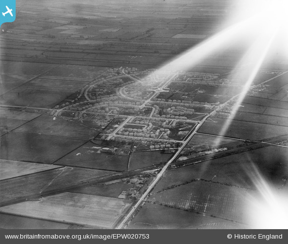
EPW020753 ENGLAND (1928). Moorends, Thorne, 1928
© Copyright OpenStreetMap contributors and licensed by the OpenStreetMap Foundation. 2025. Cartography is licensed as CC BY-SA.
Nearby Images (6)
Details
| Title | [EPW020753] Moorends, Thorne, 1928 |
| Reference | EPW020753 |
| Date | 11-April-1928 |
| Link | |
| Place name | THORNE |
| Parish | THORNE |
| District | |
| Country | ENGLAND |
| Easting / Northing | 469624, 415742 |
| Longitude / Latitude | -0.94695355036491, 53.633330966719 |
| National Grid Reference | SE696157 |
Pins
Be the first to add a comment to this image!


![[EPW020753] Moorends, Thorne, 1928](http://britainfromabove.org.uk/sites/all/libraries/aerofilms-images/public/100x100/EPW/020/EPW020753.jpg)
![[EPW020754] Moorends, Thorne, 1928](http://britainfromabove.org.uk/sites/all/libraries/aerofilms-images/public/100x100/EPW/020/EPW020754.jpg)
![[EPW020752] Moorends, Thorne, 1928](http://britainfromabove.org.uk/sites/all/libraries/aerofilms-images/public/100x100/EPW/020/EPW020752.jpg)
![[EPW020755] Moorends, Thorne, 1928](http://britainfromabove.org.uk/sites/all/libraries/aerofilms-images/public/100x100/EPW/020/EPW020755.jpg)
![[EPW020756A] Moorends, Thorne, 1928](http://britainfromabove.org.uk/sites/all/libraries/aerofilms-images/public/100x100/EPW/020/EPW020756A.jpg)
![[EPW020756] Moorends, Thorne, 1928](http://britainfromabove.org.uk/sites/all/libraries/aerofilms-images/public/100x100/EPW/020/EPW020756.jpg)