
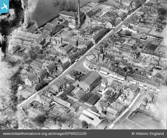
EPW021106 ENGLAND (1928). The junction of King Street and Chapel Street, Belper, 1928
© Copyright OpenStreetMap contributors and licensed by the OpenStreetMap Foundation. 2025. Cartography is licensed as CC BY-SA.
Nearby Images (20)
EPW021106

EPW036059

EPW021107

EPW036064

EPW036027

EPW036021

EPW036023

EPW036029

EPW036022

EPW036025

EPW021109

EPW036030

EPW036028

EPW036019

EPW036058

EPW036026

EPW036018

EPW036024

EPW036020

EPW036017

Details
| Title | [EPW021106] The junction of King Street and Chapel Street, Belper, 1928 |
| Reference | EPW021106 |
| Date | April-1928 |
| Link | |
| Place name | BELPER |
| Parish | BELPER |
| District | |
| Country | ENGLAND |
| Easting / Northing | 434670, 347438 |
| Longitude / Latitude | -1.4830642362266, 53.022805568987 |
| National Grid Reference | SK347474 |
Pins
Be the first to add a comment to this image!