
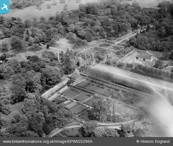
EPW021296A ENGLAND (1928). Blickling Hall, Blickling, 1928
© Copyright OpenStreetMap contributors and licensed by the OpenStreetMap Foundation. 2025. Cartography is licensed as CC BY-SA.
Nearby Images (18)
EPW021296A

EAW051630

EAW018541

EPW039266

EAW051629

EAW018540

EAW018542

EPW039268

EAW051632

EAW051633

EPW039265

EAW051634

EAW018543

EAW018545

EAW051631

EPW039267

EPW039264

EAW051635

Details
| Title | [EPW021296A] Blickling Hall, Blickling, 1928 |
| Reference | EPW021296A |
| Date | May-1928 |
| Link | |
| Place name | BLICKLING |
| Parish | BLICKLING |
| District | |
| Country | ENGLAND |
| Easting / Northing | 617844, 328663 |
| Longitude / Latitude | 1.2327397231494, 52.811099355489 |
| National Grid Reference | TG178287 |
Pins
 totoro |
Wednesday 23rd of July 2014 06:53:41 PM | |
totoro |
Wednesday 23rd of July 2014 06:52:04 PM | |
totoro |
Wednesday 23rd of July 2014 06:49:55 PM | |
totoro |
Wednesday 23rd of July 2014 06:45:00 PM | |
totoro |
Wednesday 23rd of July 2014 06:34:21 PM |
User Comment Contributions
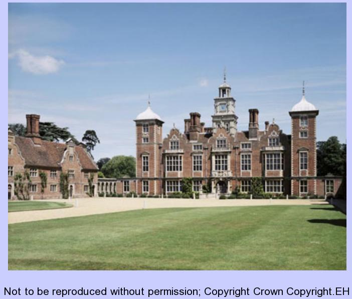 South front and West forecourt wing view from South East on 24 JUN 1993 Not to be reproduced without permission; Copyright Crown Copyright.EH Photographer: Ms Patricia Payne Source:http://www.englishheritagearchives.org.uk/SingleResult/Default.aspx? id=121857&t=Quick&cr=blickling&io=True&l=all |
totoro |
Wednesday 23rd of July 2014 07:02:43 PM |