
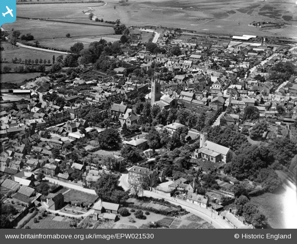
EPW021530 ENGLAND (1928). St Mary's Church and the town, Bungay, 1928
© Copyright OpenStreetMap contributors and licensed by the OpenStreetMap Foundation. 2025. Cartography is licensed as CC BY-SA.
Nearby Images (6)
EPW021530

EPW021528

EPW021529

EAW014069

EAW014070

EPW021531

Details
| Title | [EPW021530] St Mary's Church and the town, Bungay, 1928 |
| Reference | EPW021530 |
| Date | June-1928 |
| Link | |
| Place name | BUNGAY |
| Parish | BUNGAY |
| District | |
| Country | ENGLAND |
| Easting / Northing | 633690, 289707 |
| Longitude / Latitude | 1.4398779579461, 52.454859291467 |
| National Grid Reference | TM337897 |
Pins
 Glen37037 |
Wednesday 27th of June 2012 07:39:58 PM | |
Glen37037 |
Wednesday 27th of June 2012 07:37:36 PM | |
Glen37037 |
Wednesday 27th of June 2012 07:35:18 PM |