
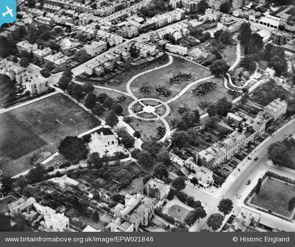
EPW021846 ENGLAND (1928). Sandford Park, Cheltenham, 1928
© Copyright OpenStreetMap contributors and licensed by the OpenStreetMap Foundation. 2025. Cartography is licensed as CC BY-SA.
Nearby Images (9)
EPW021846

EPW021850

EPW021849

EPW021844

EPW021848

EPW021845

EPW021847

EPW021843

EPW000167

Details
| Title | [EPW021846] Sandford Park, Cheltenham, 1928 |
| Reference | EPW021846 |
| Date | July-1928 |
| Link | |
| Place name | CHELTENHAM |
| Parish | |
| District | |
| Country | ENGLAND |
| Easting / Northing | 395244, 221963 |
| Longitude / Latitude | -2.0691246180403, 51.895757928322 |
| National Grid Reference | SO952220 |
Pins

User Comment Contributions
 Sandford Park 27/09/2013 |
 Class31 |
Monday 27th of January 2014 02:58:57 PM |