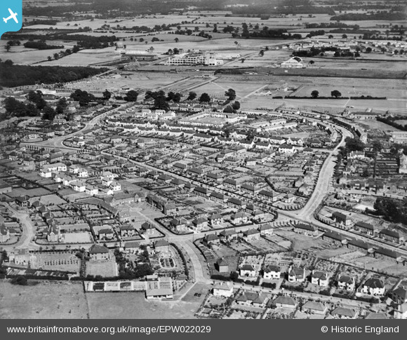
EPW022029 ENGLAND (1928). The Town Centre, Welwyn Garden City, from the west, 1928
© Copyright OpenStreetMap contributors and licensed by the OpenStreetMap Foundation. 2025. Cartography is licensed as CC BY-SA.
Nearby Images (8)
Details
| Title | [EPW022029] The Town Centre, Welwyn Garden City, from the west, 1928 |
| Reference | EPW022029 |
| Date | July-1928 |
| Link | |
| Place name | WELWYN GARDEN CITY |
| Parish | |
| District | |
| Country | ENGLAND |
| Easting / Northing | 522884, 212912 |
| Longitude / Latitude | -0.21766423177602, 51.800883667284 |
| National Grid Reference | TL229129 |


![[EPW022029] The Town Centre, Welwyn Garden City, from the west, 1928](http://britainfromabove.org.uk/sites/all/libraries/aerofilms-images/public/100x100/EPW/022/EPW022029.jpg)
![[EPW009816] Valley Road and surroundings, Welwyn Garden City, 1924](http://britainfromabove.org.uk/sites/all/libraries/aerofilms-images/public/100x100/EPW/009/EPW009816.jpg)
![[EAW020863] Smoke rising from a distant chimney beyond the town, Welwyn Garden City, from the south-west, 1949](http://britainfromabove.org.uk/sites/all/libraries/aerofilms-images/public/100x100/EAW/020/EAW020863.jpg)
![[EPW054543] The residential area surrounding Brockett Close, Dognell Green and Dellcott Close, Handside, 1937](http://britainfromabove.org.uk/sites/all/libraries/aerofilms-images/public/100x100/EPW/054/EPW054543.jpg)
![[EPW022019] Youngs Rise and Valley Road, Welwyn Garden City, 1928](http://britainfromabove.org.uk/sites/all/libraries/aerofilms-images/public/100x100/EPW/022/EPW022019.jpg)
![[EPW022036] High Oaks Road and Dognell Green housing, Welwyn Garden City, 1928](http://britainfromabove.org.uk/sites/all/libraries/aerofilms-images/public/100x100/EPW/022/EPW022036.jpg)
![[EPW054523] The residential area at Handside and Sherrardspark Wood, Welwyn Garden City, 1937](http://britainfromabove.org.uk/sites/all/libraries/aerofilms-images/public/100x100/EPW/054/EPW054523.jpg)
![[EPW054524] The residential area at Handside and Sherrardspark Wood, Welwyn Garden City, 1937](http://britainfromabove.org.uk/sites/all/libraries/aerofilms-images/public/100x100/EPW/054/EPW054524.jpg)
